You have probably seen the photo: a ring of rock open to the sky, a crescent of sand at the bottom and turquoise water spilling in through a tunnel. That is Hidden Beach, also called Playa del Amor (Beach of Love), on the Marietas Islands off the coast of Riviera Nayarit, near Puerto Vallarta. It is one of the most famous beaches in Mexico, and also one of the most protected.
The story behind it is just as striking as the view. These tiny islands have been a military bombing range, survived a major fire, become a seabird sanctuary, gone viral and been shut down to recover. Here is what the Marietas Islands are, how they got here, why Hidden Beach closed in 2016 and what to expect if you want to visit.
What Are the Marietas Islands?
The Marietas Islands are a small, uninhabited archipelago at the mouth of Banderas Bay, in the state of Nayarit, within the municipality of Bahía de Banderas. The two main islands are Isla Larga ("Long Island") and Isla Redonda ("Round Island"), plus a handful of islets and rocks. They sit roughly 8 km (about 5 miles) southwest of Punta de Mita (sources range from 6 to 9.5 km depending on where you measure) and about 39 km (24 miles) west of Puerto Vallarta. By boat it is around 15 minutes from Punta de Mita and about an hour from Puerto Vallarta.
The national park covers about 1,383 hectares (roughly 3,400 acres), and nearly all of it is ocean: the marine area makes up about 94% of the park, while the land itself is tiny.
The islands are volcanic in origin. They formed thousands of years ago, and since then the ocean has carved caves, arches and tunnels into the rock. The water around them is roughly 70 to 110 feet deep.
Here is a detail most visitors miss: the park's management program describes the Marietas as the southernmost members of the Gulf of California islands, the island group UNESCO recognizes as a World Heritage Site. Mexico's protected-areas agency also counts them as part of Nayarit's "island biodiversity protection triangle."
Today the Marietas Islands are a protected area with several designations:
- National Park since April 25, 2005, by federal decree.
- Ramsar Site (a wetland of international importance, site no. 1345) since 2004.
- Part of the World Heritage Site "Islands and Protected Areas of the Gulf of California" (2005), according to CONANP.
- UNESCO Biosphere Reserve (Man and the Biosphere program) since 2008.
The park is managed by CONANP, Mexico's National Commission of Natural Protected Areas, with enforcement support from the Mexican Navy.
Caves, Arches and Hidden Corners
Hidden Beach is the headliner, but the official park map names other spots your guide may point out: Playa La Nopalera and the Stone Steps (Escalones de piedra) on Isla Larga, the Cave of the Dead (Cueva del Muerto), the Stone Arch (El Arco de Piedra) and El Amarradero.
Not everything is open to visitors. The management program divides the park into core zones (about 78 hectares), which protect the islands where seabirds nest and some reef areas, and a buffer zone, almost entirely marine, where guided snorkeling and diving, birdwatching from boats and permitted fishing in certain areas are allowed.
Wildlife on the Marietas Islands
The islands are a seabird haven. According to the management program, 92 bird species have been recorded here, breeding, resting or passing through. The stars are blue-footed boobies, brown boobies and red-billed tropicbirds. The protected zones on Isla Larga and Isla Redonda shelter more than a dozen seabird species, and the management program describes the Marietas brown booby colony as the largest breeding colony of the species in the world. The same source says the islands protect half of Mexico's bridled terns.
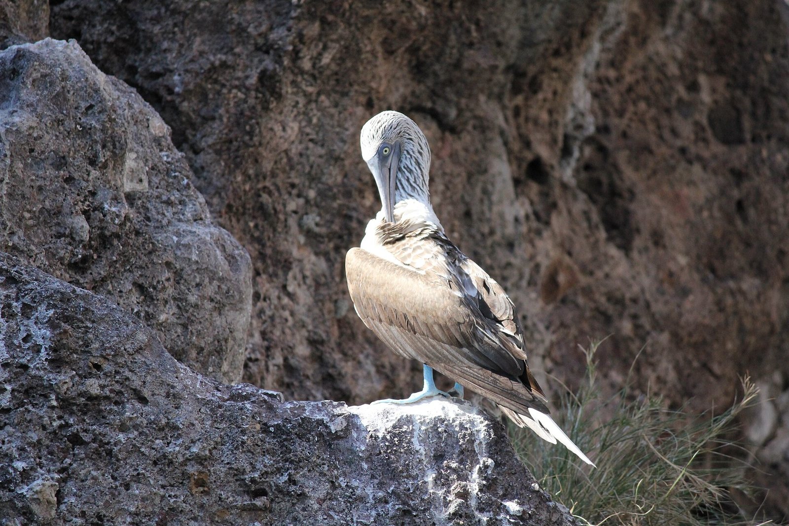 A blue-footed booby on the Marietas Islands.
The boobies have also been studied up close. In 2013 a research team tracked blue-footed and brown booby nests on Isla Larga week by week to see whether tourist visits hurt breeding. Their results, published in 2016, found that tourist presence, as they measured it, did not explain nesting failures; other factors were limiting breeding success for both species.
On land, plant life is sparse and tough, built for salt and wind: grasses, sedges, ferns and wild bromeliads. Reptiles include the Mexican spiny-tailed iguana (black iguana) and the many-lined whiptail, both endemic to Mexico, according to CONABIO species lists.
The real richness is underwater. CONANP says the Marietas hold the most important reef formations in Banderas Bay, with more than 10 coral species (mostly Pocillopora) and around 115 fish species. Angelfish, Moorish idols and parrotfish are common; with luck you may see manta rays, dolphins and olive ridley sea turtles. Overall, CONABIO records list more than 400 plant and animal species, and the management program counts 44 species under some level of risk in Mexico.
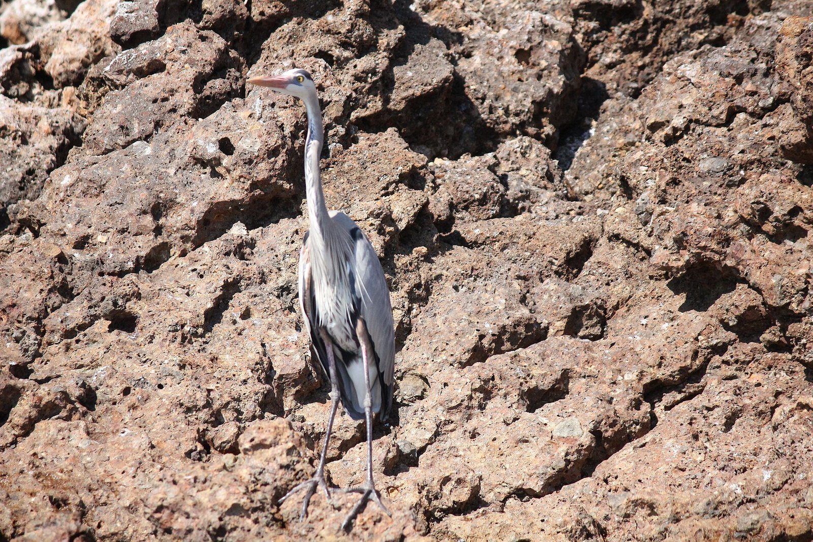 A heron on the rocks of the Marietas Islands.
Humpback Whales Around the Islands
Every winter humpback whales arrive in Banderas Bay to mate and give birth, and the waters around the Marietas matter so much to mothers with calves that the management program bans tourist whale watching there. On top of that, Mexico's environment ministry (Semarnat) set a 1.5 km (about 1 mile) radius around the archipelago as a no-whale-watching zone for the 2025–2026 season, which ran from December 8 to March 23. To plan a whale trip, see our guide to whale watching in Puerto Vallarta.
How Hidden Beach Was Formed: Bombs, Erosion and a Bit of Legend
The islands have always been uninhabited, and starting in the early 1900s the Mexican government used them for military practice. This part is not just folklore: the park's management program summary notes that the Marietas once served as an aerial firing range. What remains unproven is the most famous part of the story, that the explosions, combined with erosion, opened the hole that now frames Hidden Beach. We could not find an official or scientific source confirming it, so treat it as popular history.
Several sources credit ocean explorer Jacques Cousteau, in the 1960s, as one of the voices calling for the testing to stop and the islands to be protected.
Before formal protection, the islands were a casual day trip: locals came out for picnics and cookouts on the beaches. That changed in 1997, when a serious fire swept the islands and landing was restricted afterward. Local civil groups then pushed for the Marietas to become a protected area, which finally happened in 2005.
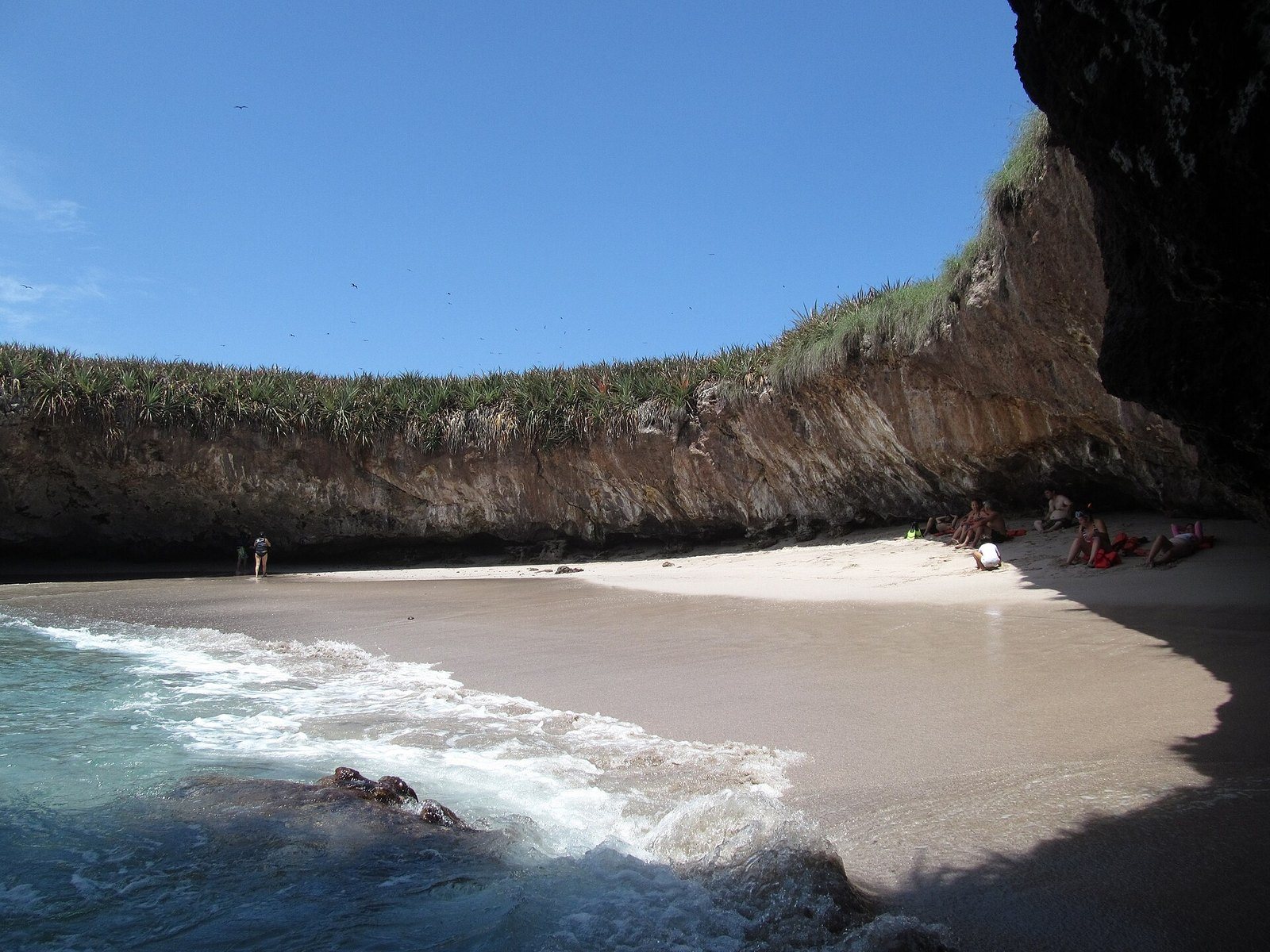 Hidden Beach seen from the water, Marietas Islands National Park.
Why the Marietas Islands Closed in 2016
Fame came at a cost. Photos of the beach inside the crater went viral, and visitor numbers soared from about 27,500 in 2012 to more than 127,000 in 2015. Over Easter 2016, more than 27,000 people came in two weeks, with peaks of up to 3,000 in a single day and about 230 boats daily, several times what the management program allowed for.
On April 14, 2016, CONANP announced a closure, and access was cut off starting May 9, 2016. The agency blamed boat anchoring, mass diving, crowding at a single spot, fuel, oil and trash pollution, and the removal of coral, crustaceans and mollusks by visitors and illegal fishermen. A University of Guadalajara study had documented coral damage.
During the closure, crews worked on reef restoration and cleaned the beach and seabed. Hidden Beach reopened in late August 2016 with a daily visitor limit, small groups, a short time on the sand, rest days for the ecosystem and equipment restrictions. Between July and September that year, CONANP trained and accredited more than 170 guides, the only ones allowed to take visitors to the beach.
Those rules were published in 2016 and may have changed since, so we are not listing specific numbers here. Check the current rules with CONANP or your boat operator before you go.
Marietas Islands Timeline
- Thousands of years ago: volcanic activity forms the islands; the sea carves caves, arches and tunnels.
- From the early 1900s: the Mexican government uses the uninhabited islands for military practice; the management program recalls they were an aerial firing range.
- 1960s: Jacques Cousteau joins the calls to protect them.
- 1997: a serious fire hits the islands; landing is restricted.
- February 2, 2004: designated a Ramsar Site.
- April 25, 2005: decree creating Islas Marietas National Park.
- 2007: the park's management program is published.
- 2008: UNESCO names them a Biosphere Reserve.
- 2012–2015: annual visitors jump from about 27,500 to more than 127,000.
- May 9, 2016: CONANP closes Hidden Beach over environmental damage.
- Late August 2016: reopening with a visitor cap and strict rules; guides are certified afterward.
How to Visit the Marietas Islands Today
- By boat, with an authorized operator only. There is no way to reach the islands by land. To enter Hidden Beach you need to go with a tour company that holds a permit to operate in the national park.
- You swim in. Boats stay outside, and the last stretch is a swim through a rock tunnel, about 20 meters (65 feet) long according to the municipal profile, that connects the open ocean with the beach. You should be a confident swimmer; life jackets are typically used, and access depends on tides and swell (at high tide the tunnel may not be safe).
- Spots are limited. Because daily entries are capped, book well ahead during high season.
- Some days there is no access. The beach has rest days and can close for bad weather. Your operator will tell you which days are available.
- There is a park fee. Under the management program, visitors pay a federal entry fee (children under 6 and people with disabilities are exempt). Ask whether your tour already includes it.
- Follow park rules. Don't touch or stand on coral, don't take sand, shells or rocks, don't feed or disturb wildlife, and pack out all trash. The management program also asks visitors to avoid alcohol during tourist activities and bans campfires, camping, rock climbing and paragliding.
Boats commonly leave from Punta de Mita, La Cruz de Huanacaxtle, Nuevo Vallarta or Puerto Vallarta. If you are staying on the north shore of the bay, our guides to Punta Mita and Nuevo Vallarta can help you plan.
Heads-up: not every Marietas trip lands at Hidden Beach. Many stick to snorkeling or a cruise around the islands, so ask before you pay.
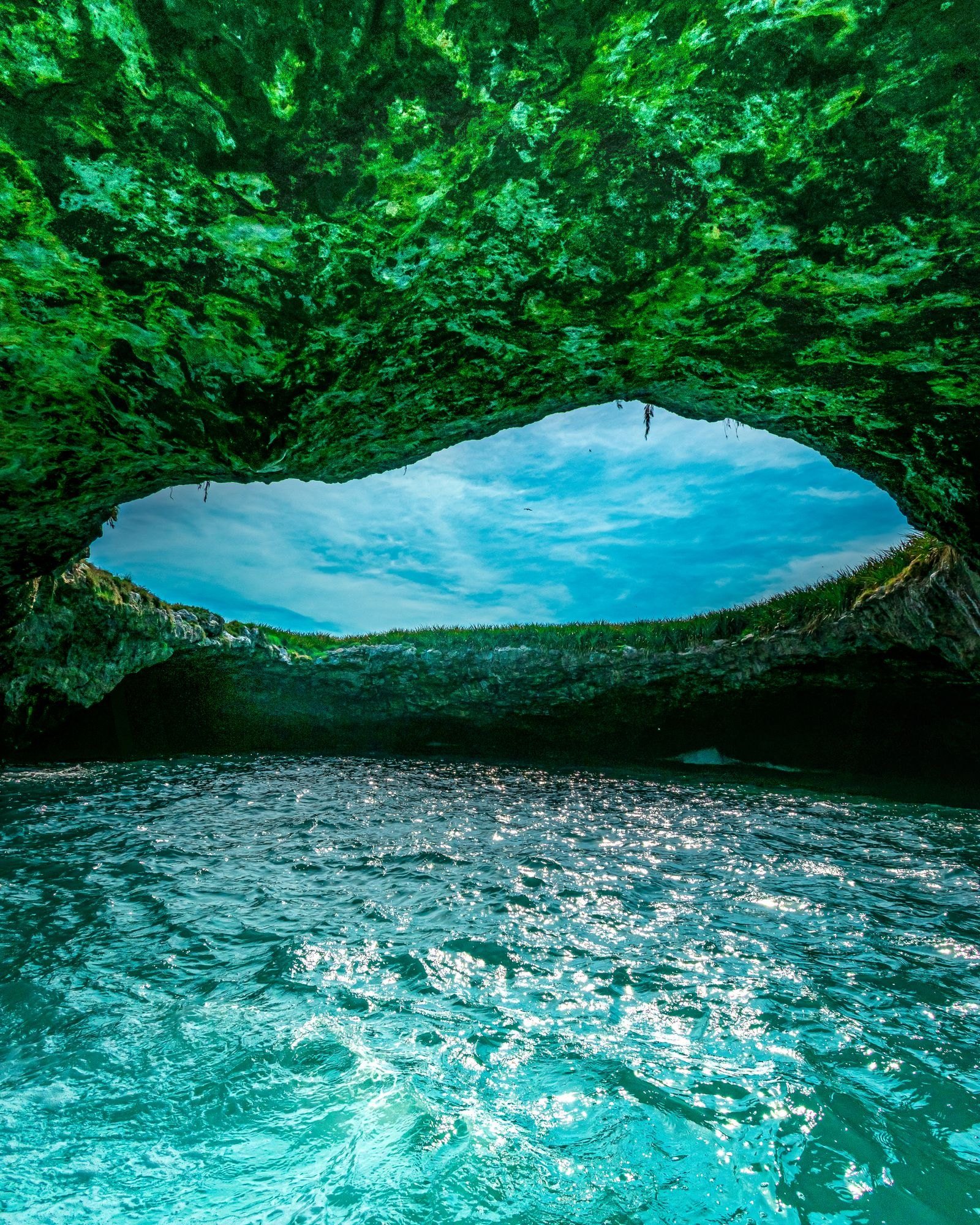 Hidden Beach seen from inside the cave.
Best Time to Go
Banderas Bay has a warm, semi-humid climate, with average annual temperatures of roughly 73–82°F (23–28°C) and a summer rainy season, mostly June through September. The eastern Pacific hurricane season runs from May 15 to November 30, so cancellations for rough seas are more likely then. December through March usually brings calmer water and whales along the way, though it is also high season.
Sample Itinerary
Half day: head out early from Punta de Mita or La Cruz, do the islands trip (snorkeling and, if included, Hidden Beach) and be back for lunch. Spend the afternoon on El Anclote beach in Punta de Mita.
Full day: add an afternoon in Bucerías or La Cruz de Huanacaxtle, and save another day for Sayulita and San Pancho.
What to Bring and How to Budget
Wear your swimsuit and bring a rash guard, reef-safe sunscreen, a dry bag, a towel, water and some cash. Prices vary a lot depending on the type of boat, whether Hidden Beach access is guaranteed and whether food and drinks are included; the park fee may come on top.
Does Riviera Tours & Transfers Go to the Marietas Islands?
No. Riviera Tours & Transfers does not offer a Marietas Islands tour; entering the park requires a licensed boat operator. If you also want to see the Riviera Nayarit coast by land, you can join our Sayulita and San Pancho tour, a full-day trip that does not include the Marietas Islands or Punta Mita. It runs Tuesday, Thursday and Saturday, in English or Spanish, with groups of up to 17 people. It includes:
- Round-trip transportation
- Certified tour guide
- Tasting of traditional Mexican sweets
- Visit to the plaza and beach in San Pancho
- Guided walking tour of downtown Sayulita
- Free time in Sayulita
- Bottled water
Lunch is not included. Optional: surf lessons at an extra cost, with a 50% discount for tour guests.
See dates and book the Sayulita and San Pancho tour →
For more ideas nearby, read our guides to things to do in Sayulita, Riviera Nayarit beach towns and sea turtles in Riviera Nayarit.
Tips for Visiting the Marietas Islands
- Use reef-safe sunscreen, or better yet a rash guard, to protect the coral. Ask your operator what is allowed.
- Be honest about your swimming. The tunnel can have currents and waves. If you are not a strong swimmer, tell the crew before you leave.
- Pack light. A dry bag, water and a towel. Everything you bring must leave with you.
- Prone to seasickness? Factor that in before you book.
- Watch the clock: the Bahía de Banderas area (Punta Mita, Nuevo Vallarta, La Cruz) is on the same time as Puerto Vallarta (Central Time). Confirm your departure time with the operator.
FAQ
Can I visit Hidden Beach without a tour? No. Access to Hidden Beach is regulated by CONANP and only allowed with authorized operators and accredited guides. Confirm current conditions with them.
How many people can visit Hidden Beach per day? There has been a daily cap since the 2016 reopening, but the number and schedule can change. Check with CONANP or your operator before planning.
Was Hidden Beach really created by bombs? It is documented that the islands were a military firing range in the 20th century. That the explosions opened the hole is a popular story with no official confirmation, so think of it as local legend with some historical basis.
When is the best time to visit the Marietas Islands? December through March usually has calmer seas and whales along the way. Summer and fall bring rain and hurricane season, with more cancellations.
Can you see whales at the Marietas Islands? You can see humpbacks in Banderas Bay in winter, but there is a no-whale-watching zone around the islands to protect mothers and calves. Check the current season's restricted zones.
Is there a fee to enter the park? Yes, there is a federal visitor fee, with exemptions for children under 6 and people with disabilities. Ask your operator whether it is included.
Does Riviera Tours & Transfers go to the Marietas Islands? No. You will need a licensed boat operator. For a coastal day trip by land, try our Sayulita and San Pancho tour.
Photos: Luis Carlos Soria Contreras / CC BY-SA 4.0 via Wikimedia Commons · Christian Frausto Bernal / CC BY-SA 2.0 via Wikimedia Commons · terri_bateman / CC BY 2.0 via Wikimedia Commons (2 photos) · Jorge Medina / Pexels License via Pexels