Head north from Puerto Vallarta into the state of Nayarit and, once you're past the resorts of Nuevo Vallarta, the coast turns into a string of former fishing villages. They have grown with tourism, but they still have cobblestone streets, plazas with bandstands, fishing boats pulled up on the sand and very fresh seafood. Here are three worth knowing: Bucerías, La Cruz de Huanacaxtle and Lo de Marcos, with their history, their festivals and what to do in each.
Where They Are: A Quick Map of the Riviera Nayarit
All three towns belong to the municipality of Bahía de Banderas, Nayarit, which runs on Central Time, the same as Puerto Vallarta. You don't need to change your watch to visit them, even though most of Nayarit is one hour behind on Pacific Time.
From south to north, the order goes roughly like this:
- Nuevo Vallarta, the first stop once you enter Nayarit (our Nuevo Vallarta guide).
- Bucerías, right on the beach between Nuevo Vallarta and La Cruz.
- La Cruz de Huanacaxtle, a bit farther along the north shore of the bay, on the way to Punta Mita.
- Sayulita and San Pancho, farther north on Highway 200. Local buses run along this stretch.
- Lo de Marcos, about 11 km (7 miles) north of San Pancho.
Bucerías and La Cruz sit inside Banderas Bay, where the water is usually calm; Lo de Marcos is outside the bay. Short on time? Pair Bucerías and La Cruz in one morning (ideally a high-season Sunday, for the market) and save Sayulita, San Pancho and Lo de Marcos for another day.
A Short History of the Banderas Bay Coast
Before the Spanish. The north shore of the bay was part of the old lordship of Xalisco, with three main chiefdoms in the area: Tintoque, Pontoque and Tondoroque.
Why "Banderas"? Around 1525, Francisco Cortés de San Buenaventura, a relative of Hernán Cortés, reached this coast. The most common story is that local people greeted him carrying colorful feather banners, which gave the valley and later the bay its name: banderas means "flags." Around 1530, Nuño Beltrán de Guzmán's expedition brought a violent conquest that left much of the region depopulated.
The 20th century. In 1937, under President Lázaro Cárdenas, land was handed out to farmers, creating most of today's ejidos (communal farmlands). In 1970 the federal government set up the Bahía de Banderas Trust to promote tourism. In 1989 the Nayarit state congress split the area off from Compostela and created the municipality of Bahía de Banderas, which had about 187,000 residents by 2020. The Riviera Nayarit brand is even newer: the state government launched it in 2007, with the sea turtle as its emblem.
Timeline at a Glance
- Around 1525: Francisco Cortés de San Buenaventura arrives; the name "Banderas" is born.
- Around 1864: Bucerías begins, then called Santa Julia de las Tablas.
- 1930s: La Cruz de Huanacaxtle is founded.
- 1970: The Bahía de Banderas Trust is created.
- 1989: The municipality of Bahía de Banderas is created.
- 2007: The Riviera Nayarit brand is launched.
- 2008: The La Cruz harbor renovation is completed.
- 2014: The El Buzo statue is unveiled in Bucerías.
Bucerías: A Long Beach with Small-Town Charm
Location and distance. Bucerías is about 18 km (11 miles) from the Puerto Vallarta airport, which makes it one of the easiest Riviera Nayarit beach towns to reach. Depending on traffic, the drive from the airport is around half an hour. With roughly 16,000 residents (2020 census), it's the largest of the three towns.
From Santa Julia de las Tablas to "place of divers." The town dates back to around 1864, when Spanish ships stopped here to trade timber, hence its first name, Santa Julia de las Tablas ("of the planks"). "Bucerías" is usually translated as "place of divers": for generations, local fishermen dove in the calm bay waters to bring up oysters. According to the Riviera Nayarit Convention and Visitors Bureau, some divers from the bay worked for American pearl companies around 1880.
El Buzo. In 2014, as part of the waterfront makeover, the town unveiled a bronze statue about 4 meters (13 feet) tall called El Buzo ("The Diver"). It's the work of Jalisco sculptor Octavio González Gutiérrez with local artist Luis Armando Solorio. According to Atlas Obscura, the figure was modeled on Ramón Barraza, who spent some 40 years diving for oysters here.
How tourism changed it. Before tourism, people lived from fishing and farming (corn, peanuts and fruit). In the 1980s Canadians began arriving in RVs to spend the winter, and today seasonal visitors roughly double the population. Highway 200 splits the town in two: the hillside half is mostly local families, while the beach side is home to many foreign residents, both full-time and part-time.
The beach. It's one of the longest beaches on Banderas Bay, with fine golden sand and generally gentle waves, great for long walks and for families with kids. Palapas and seafood stands line the sand.
The Our Lady of Peace festival. The town's patron saint is honored from January 16 to 24 with Masses, cultural and sports events, and a street bazaar of regional art and textiles. On the 24th, fishing families make a pilgrimage by sea, carrying the Torch of Peace from La Cruz de Huanacaxtle to Bucerías. A legend often repeated by local guides says the boat bringing the image of the Virgin hit rough seas, the sailors prayed to reach shore safely, and that's how she got her name. Treat it as folklore, not documented history.
Things to do in Bucerías:
- Wander the center: cobblestone streets, colorful houses, the main square with its bandstand and the parish church.
- Find the El Buzo statue on the waterfront.
- Browse the galleries and craft stalls; downtown gets lively in the evening.
- Visit in January, if you can, to see the patron saint festival.
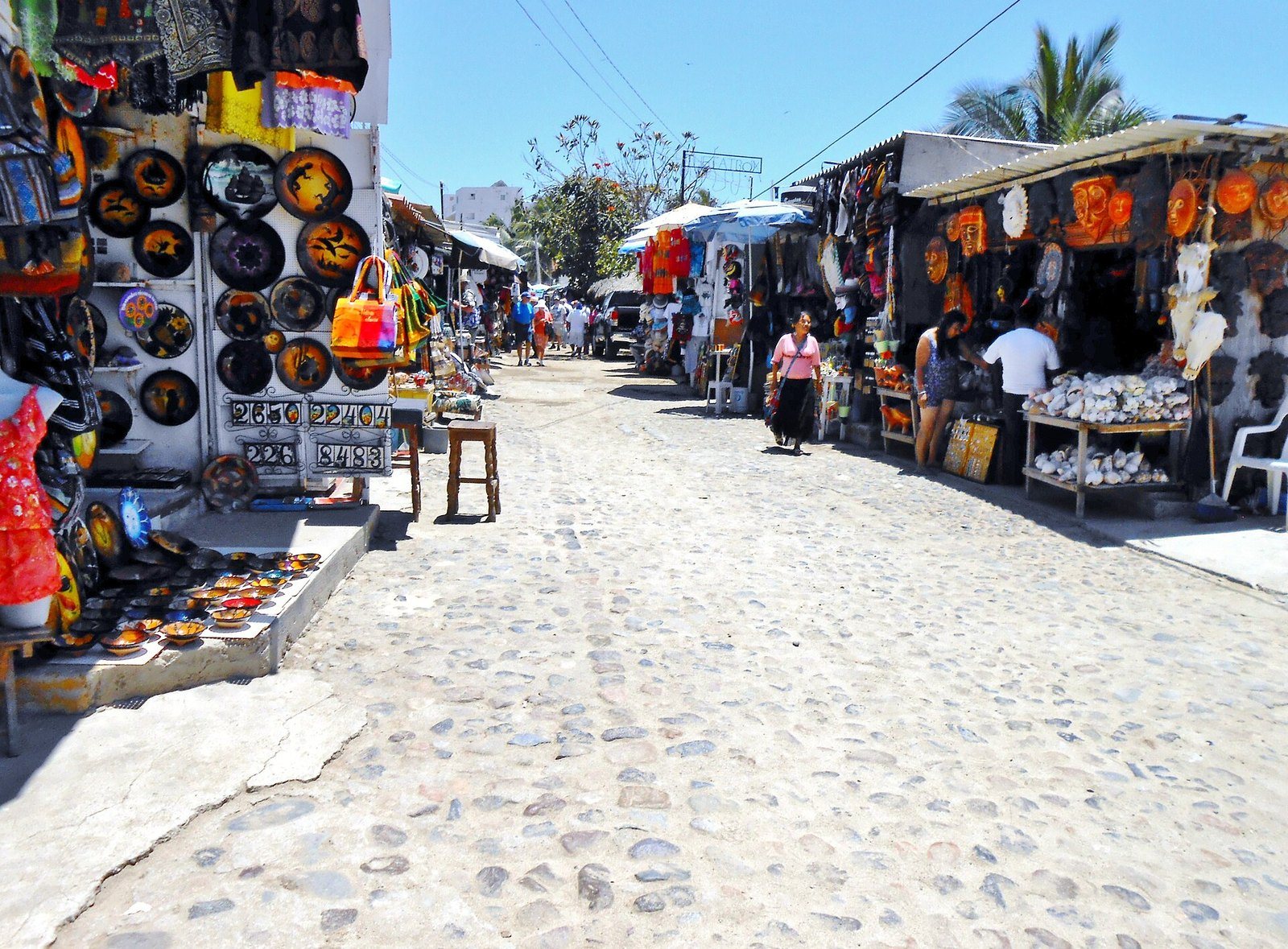 Handicraft stalls on a cobblestone street in Bucerías.
La Cruz de Huanacaxtle: Marina, Fishermen and the Sunday Market
Location and distance. La Cruz is about 25 km (15 miles) from Puerto Vallarta, past Bucerías, on the road that continues toward Punta Mita.
The name. It comes from a cross made of huanacaxtle wood that once stood at the entrance to town, although some sources note that the exact origin isn't fully documented. The huanacaxtle (Enterolobium cyclocarpum), also called parota or guanacaste, is one of the largest trees in tropical Mexico: it can top 30 meters (100 feet), with a very wide crown and a curled, ear-shaped seed pod, which is why it's nicknamed the "elephant ear" tree in English.
The founding families. La Cruz is a young town, founded in the 1930s by the Chávez family, with the Blanca family among the first settlers. Both families still live here, and the Chávez family still keeps a mango orchard on the edge of town.
The marina. A major harbor renovation was completed in 2008, and the marina can now handle vessels up to about 400 feet long. There's also a large anchorage that's popular with sailors cruising the Pacific coast. Even so, La Cruz still feels like a fishing town: you'll see pangas and nets near the docks, and there's a fish and seafood market by the marina.
The La Cruz Sunday Market. The Mercado Huanacaxtle, better known as the La Cruz Market, started in 2009 as a neighborhood project and sets up along the marina on Sundays. Around 170 vendors sell crafts, clothing, baked goods, organic produce and food, and there's often live music. It runs during high season, roughly November through April, in the morning until about 2 p.m. Opening dates and hours shift from year to year, so check the market's official social media before you go.
The Holy Cross festival. The town's patron is the Holy Cross (Santa Cruz), and the festival peaks on May 3, which in Mexico is also Construction Workers' Day. In past years it has run for nine days, with processions, fireworks and a festival queen. On the morning of May 3, fishermen take their decorated boats out on the bay carrying the cross, then return to church for Mass. Check each year's program with the parish or the municipality.
Things to do in La Cruz:
- Visit the Sunday market (in season).
- Stroll the marina boardwalk and look at the boats.
- Eat fresh fish and seafood in town.
- Get out on the water: boat outings and charters leave from the marina. If you're thinking about the Marietas Islands, always make sure your operator is authorized.
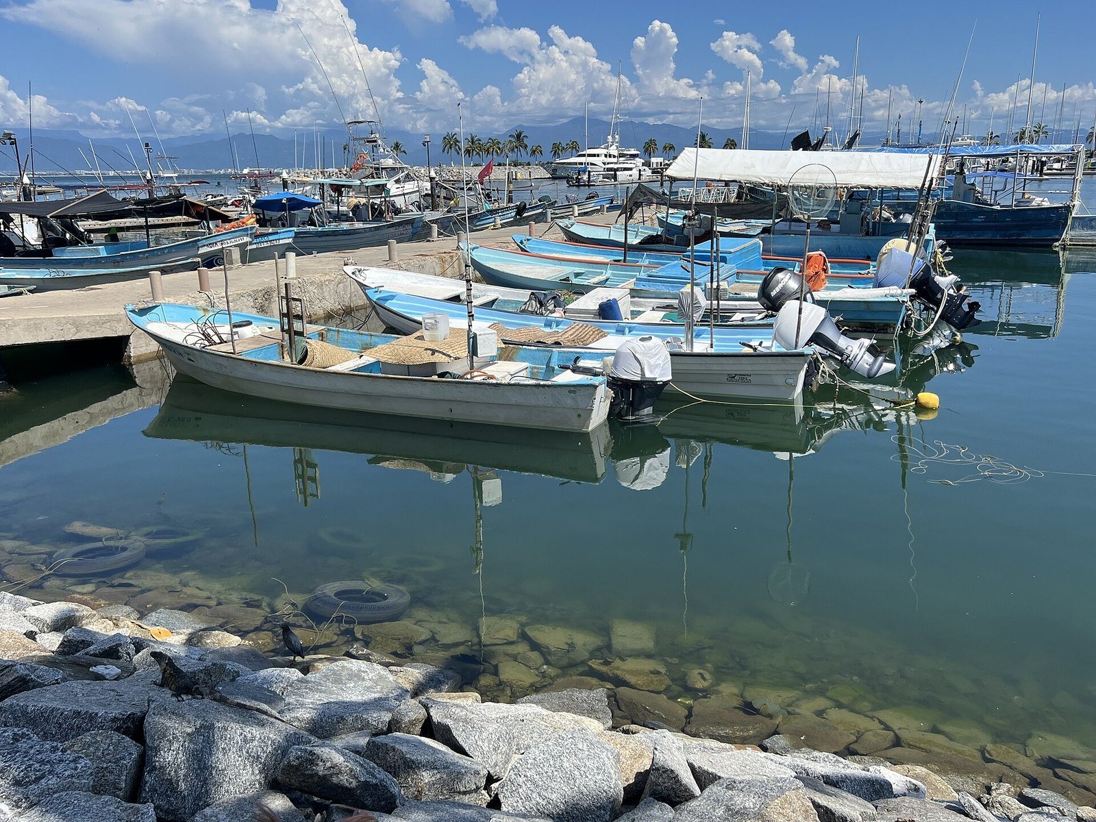 Fishing boats on the north shore of Banderas Bay.
Lo de Marcos: The Quietest of the Three
Location and distance. Lo de Marcos is about 11 km (7 miles) north of San Pancho and about 52 km (32 miles) from the Puerto Vallarta airport, roughly an hour's drive along Highway 200.
The vibe. It's a small town (about 2,100 residents in 2020) with a plaza and bandstand, quiet streets and fishermen mending nets near the beach. In the evening, food stalls pop up around the plaza.
A name with a legend. "Lo de Marcos" roughly means "Marcos's place," a turn of phrase that's more common in Argentina or Spain than in Mexico. According to a local tradition reported by México Desconocido, most of the land once belonged to a wealthy landowner named Marcos, and people heading to his property would say they were going "a lo de Marcos." There's no document to prove it.
From hamlet to town. Census figures show how young the town really is: 34 people lived here in 1900, about 200 in 1950, more than 1,000 by 1980, and 2,099 in 2020. Winter tourism arrived with retirees from Canada and the U.S.; there are so many visitors from Quebec that the north end of town is nicknamed the "French Quarter."
The beaches. The main beach is wide, with golden sand, and nearby you'll find small coves tucked between hills and rocks, such as Los Venados, Las Minitas and El Atracadero. Depending on the day, the water can be calm enough for swimming or have waves for surfing.
Nature. The surrounding hills are covered in tropical vegetation with birds, butterflies and iguanas, and there's an estuary for birdwatching. The town also has a sea turtle camp that invites the public to hatchling releases in season; learn more in our guide to sea turtles in the Riviera Nayarit.
Things to do in Lo de Marcos:
- Spend a lazy beach day and eat grilled fish by the water.
- Rent a kayak or surfboard in town.
- Go fishing with local boat captains (mahi-mahi, red snapper or sierra, depending on the season).
- Look for humpback whales from shore, roughly November through April.
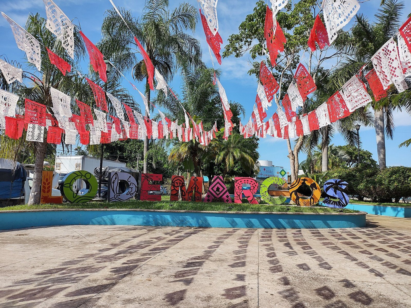 The Lo de Marcos letters in the town plaza.
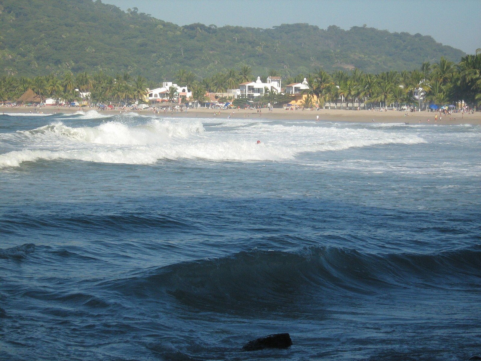 Looking north across the bay at Lo de Marcos.
Nature and Weather on the North Shore
Weather. Based on Puerto Vallarta data, the rainy season runs from mid-June to mid-October, with August the wettest month. Winter highs are around 27 °C (81 °F) with lows near 17 °C (63 °F); summer highs top 30 °C (86 °F). November through May is the most comfortable time to visit.
Humpback whales. They arrive every winter to mate and give birth. For the 2025–2026 season, Mexico's environment agency (Semarnat) set the official whale-watching season in Banderas Bay from December 8 to March 23 and banned boat-based watching in a 2 km (1.2-mile) coastal strip between Punta Mita and the Ameca River, where mothers and calves gather: right off Bucerías and La Cruz. Rules change every year, so check the current notice. More in our whale watching guide.
Local Flavors: What to Try
- Pescado zarandeado: a whole fish butterflied, rubbed with adobo and grilled over coals in a hinged rack. Most sources trace it to Mexcaltitán, in northern Nayarit (the story of pescado zarandeado).
- Fish al mojo de ajo (garlic) or grilled, shrimp, seafood cocktails and ceviche made with the catch of the day.
- Raspados (shaved ice) for the heat: sweet, with chili or with chamoy.
For ideas on where to eat, see our guide to restaurants in Bucerías, La Cruz and Punta Mita.
Suggested Itineraries
Half day: Bucerías and La Cruz. Start in La Cruz with the market and marina (on a high-season Sunday), then head down to Bucerías, find El Buzo and finish with seafood on the beach.
Full day: the north coast. Leave early for Lo de Marcos to have the beach almost to yourself, then stop in San Pancho or Sayulita on the way back. If you'd rather not drive, our tour (below) covers San Pancho and Sayulita.
Getting around and budget. Buses run along Highway 200 and stop in the towns; for Lo de Marcos, look for buses headed to Compostela, which pass through Sayulita and San Pancho. Public transportation is cheap, and you can eat well at simple beach palapas.
Etiquette: Respecting Local Communities
- Ask before photographing people, and stay out of the fishermen's way when they launch or land their boats.
- If you come across a procession or a patron saint Mass, keep quiet and don't step into the line of pilgrims for a photo.
- During turtle season, no lights or flash on the beach at night, and only join releases run by authorized camps.
Explore the North Coast on Our Sayulita & San Pancho Tour
Our tour does not stop in Bucerías, La Cruz or Lo de Marcos, but it's an easy way to see the northern side of the Riviera Nayarit without driving. The Sayulita & San Pancho tour runs Tuesday, Thursday and Saturday. It's a full-day tour in English and Spanish, with a maximum of 17 guests, and it includes:
- Round-trip transportation
- Certified tour guide
- Tasting of traditional Mexican sweets
- Visit to San Pancho's plaza and beach
- Guided walking tour of downtown Sayulita
- Free time in Sayulita
- Bottled water
Surf lessons are available as an optional extra at a cost, with a 50% discount for tour guests. Lunch is not included.
See dates and book the Sayulita & San Pancho tour →
Tips for Visiting Riviera Nayarit Beach Towns
- Bring cash, in small bills. It's the easiest way to pay at beach stands and markets.
- Check ocean conditions. They change with the season; only swim where it's safe and follow the beach flags.
- Pack reef-safe sunscreen, a hat and water, especially around midday.
- Want more background? Read our Puerto Vallarta history guide.
FAQ
How far is Bucerías from Puerto Vallarta? About 18 km (11 miles) from the Puerto Vallarta airport, or roughly a 30-minute drive depending on traffic.
When is the La Cruz de Huanacaxtle Sunday market? On Sundays during high season, roughly November through April, along the marina until about 2 p.m. Check the market's official social media for this season's dates and hours.
Is Lo de Marcos on the same time zone as Puerto Vallarta? Yes. Lo de Marcos is in the municipality of Bahía de Banderas, which uses Central Time, the same as Puerto Vallarta.
Does the Sayulita & San Pancho tour stop in Bucerías or La Cruz? No. The tour visits San Pancho and Sayulita. For Bucerías, La Cruz or Lo de Marcos, plan a separate day on your own.
What does "Bucerías" mean? It's usually translated as "place of divers," after the local fishermen who dove for oysters. The town was once called Santa Julia de las Tablas.
When are the festivals in Bucerías and La Cruz? Bucerías celebrates Our Lady of Peace from January 16 to 24, with a pilgrimage by sea on the 24th. In La Cruz, the Holy Cross festival peaks on May 3. Check each year's program.
What's the best time to visit? November through May is cooler and mostly dry; December through March lines up whale season with the La Cruz Sunday market.
Photos: Michelle Maria / CC BY 3.0 via Wikimedia Commons · Michelle Maria / CC BY 3.0 via Wikimedia Commons · Navlilia / CC BY-SA 4.0 via Wikimedia Commons · WendyAvilesR / CC BY 4.0 via Wikimedia Commons · Elbeta / CC BY-SA 4.0 via Wikimedia Commons