If Sayulita is the party, San Pancho is the long lunch afterwards. Its official name is San Francisco, but everyone calls it San Pancho ("Pancho" is the classic Mexican nickname for Francisco). It is a small beach town with a wide beach, stunning sunsets and a community that is very active in art, culture and environmental projects.
What most visitors never hear is the story behind the calm: a 16th-century Indigenous place name, a coconut-oil hacienda, a Mexican president who tried to turn it into a model town, and a group of artists who brought its abandoned warehouses back to life. Here is that story, plus what to do, when to go and how to pair it with Sayulita.
Where Is San Pancho, Mexico?
San Pancho is in the municipality of Bahía de Banderas, Nayarit, about 50 km (30 miles) north of Puerto Vallarta on Federal Highway 200. It sits roughly 5 km (3 miles) north of Sayulita, so many visitors see both towns on the same day.
The town lies just above sea level, squeezed between the Pacific and the jungle-covered foothills of the Sierra de Vallejo, which rise right behind the houses. Its neighbors are Lo de Marcos to the north, Sayulita to the southwest and small communities such as Palmarito and El Guamúchil. Along one edge runs the Los Izotes River, which only flows in the rainy season and is nearly dry the rest of the year.
A handy detail: the whole municipality of Bahía de Banderas runs on Central Time, the same as Puerto Vallarta, so there is no need to change your watch if you are coming from there (the rest of Nayarit uses Pacific Time).
It is a small place, with about 1,400 residents in the 2020 census, and that is a big part of its charm.
San Pancho History: From Azapan to Artists' Town
First Peoples and the Name Azapan
Before the Spanish arrived, this stretch of coast and the nearby mountains were home to Indigenous peoples; sources mention groups such as the Cora and the Huichol (Wixárika), who still have a presence in the region. According to colonial-era records cited by the official Riviera Nayarit tourism site and others, around 1524 the conquistador Francisco Cortés de Buenaventura named this place Azapan (some sources spell it Apazan). At the time it was home mainly to Indigenous fishing families.
The Spanish later renamed it San Francisco de Azapan and made it part of the Jaltemba Hacienda, which produced coconut oil. The area belonged to New Galicia and traded prized sea products such as dye snails, shells and pearls, alongside other coastal settlements like Santa Cruz Saloc, the forerunner of Sayulita.
Ejido Land, Fishing and Mangoes
For centuries the region was cut off from big cities like Guadalajara, and the land was held by large estates. After the Mexican Revolution, land reform changed that: in the 1930s the communal lands (ejido) of Sayulita, which include San Pancho, were created. Sources disagree on the exact year (1931 or 1936). Until the 1970s, people lived on subsistence fishing and on mangoes and other tropical fruit.
Luis Echeverría's Model Town (1970–1976)
The big turning point came with President Luis Echeverría Álvarez. Echeverría kept a vacation home in San Pancho and, at a time when he wanted Mexico to lead the so-called Third World, he backed the idea of turning the town into a self-sufficient village.
In 1972 the government created the Bahía de Banderas Ejido Union, a pilot project that grouped eight coastal ejidos, and Federal Highway 200 opened around the same time. Federal money gave San Pancho cobblestone streets, sidewalks, streetlights, schools and a hospital. A CONASUPO agro-industrial complex was also built, with warehouses for processing dairy, canned fruit, coconut oil, seafood and more, along with experimental education centers. According to Wikipedia, the era also produced a short-lived Universidad del Tercer Mundo (Third World University), which is said to have given the main street its name: Avenida Tercer Mundo.
Decline and Rebirth
When Echeverría's term ended, the money dried up. In the 1980s the complex's businesses lost support, and by around 1988 almost every facility had been dismantled. The only one that kept running was the hospital, which today operates as an IMSS general hospital. In 1989 San Pancho moved from the municipality of Compostela to the newly created municipality of Bahía de Banderas.
In the 1990s buyers arrived from the U.S. and Canada, especially after the 1992 agrarian reform allowed ejido land to be sold. That same year the Grupo Ecológico de la Costa Verde was founded and opened the area's first sea turtle nursery. A 1996 Seattle Times travel piece described San Pancho as a quiet town of about 1,500 people, far from a tourist hot spot, where the ruins of the cannery and Echeverría's brick street were still easy to see.
The Artists Arrive
From 2006 onward, Mexican and foreign artists began taking over the old warehouses for cultural and environmental projects. That is how the San Pancho warehouses (bodegas) became a cultural hub, home to the Entreamigos community center (known for its library and recycling programs), the Alianza Jaguar conservation group and, since 2014, the training space of the Circo de los Niños, a children's circus founded in 2011 by Gilles Ste-Croix, one of the co-founders of Cirque du Soleil. That is why the region calls San Pancho the cultural capital of the Riviera Nayarit. We tell the full story in San Pancho circus and culture.
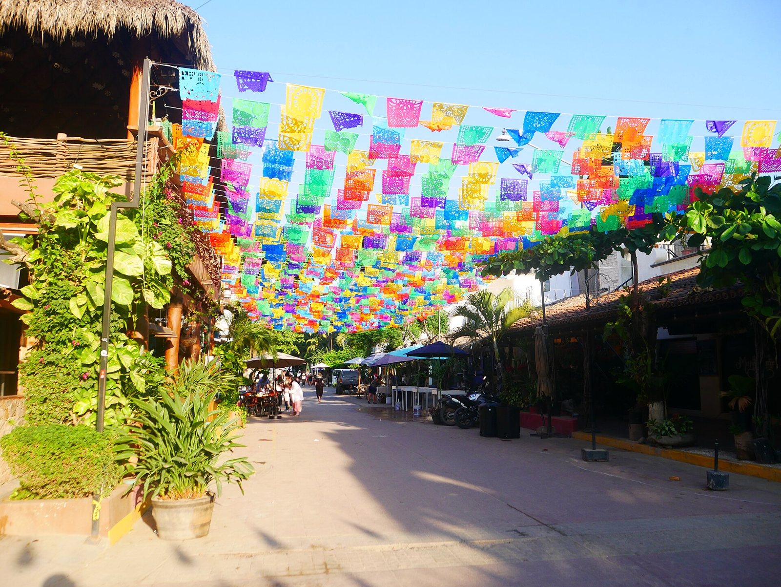 Avenida Tercer Mundo in San Pancho, decked out in papel picado.
San Pancho Timeline
- Before 1524: Indigenous peoples live along the coast and in the mountains.
- 1524: Francisco Cortés de Buenaventura names the place Azapan.
- Colonial era: known as San Francisco de Azapan, part of the coconut-oil-producing Jaltemba Hacienda.
- 1930s: the Sayulita ejido, which includes San Pancho, is formed.
- 1970–1976: Echeverría presidency; new infrastructure, hospital, schools and an agro-industrial complex.
- 1972: the Bahía de Banderas Ejido Union is created; Federal Highway 200 opens.
- Around 1988: most of the complex is dismantled; only the hospital remains.
- 1989: San Pancho becomes part of the municipality of Bahía de Banderas.
- 1992: agrarian reform allows ejido land sales; the Grupo Ecológico de la Costa Verde is founded.
- 2006: artists start reviving the warehouses; Entreamigos and the San Pancho Collective get going.
- 2011: the Circo de los Niños de San Pancho is founded.
- 2024: the decree creating the Sierra de Vallejo–Río Ameca Biosphere Reserve, which includes part of Bahía de Banderas, is published.
Fun Facts About San Pancho
- It grew, then shrank. Census figures show 374 residents in 1970, 1,823 in 2010 and 1,431 in 2020.
- The main street is named after a political idea. "Tercer Mundo" comes from Echeverría's plan to make the town a model for developing nations.
- It was a sea turtle pioneer. The Grupo Ecológico de la Costa Verde nursery, started in 1992, was the first of its kind in the area.
Living Culture: Festivals, Art and Food
The Feast of Saint Francis
The town's biggest celebration honors its patron, Saint Francis of Assisi, whose feast day is October 4. Festivities start in late September and have been held for more than four decades. Local reports describe a candlelight procession each evening, led by a different neighborhood, with floats and residents dressed as Saint Francis, ending at the church with Mass. Meanwhile the town square fills with food, music, dancing and carnival rides.
Expect classic Mexican small-town traditions: the torch, carried by runners from a nearby town; el torito, a bull-shaped frame packed with fireworks that someone carries through the crowd; rodeos; and a towering castillo of fireworks lit in the square at the finale. Dates and programs change every year, so check locally if you plan to go.
Art on the Streets
Outside festival season, art shows up on mural-covered walls, in galleries and at the Wixárika craft stalls near the beach entrance. To understand the deer, corn and peyote symbols in these pieces, read our Huichol art guide. The town also has a polo tradition, covered in polo in San Pancho.
Flavors of the Nayarit Coast
Food on this coast comes from the sea. Nayarit's signature dish is pescado zarandeado: a whole fish split open, rubbed with a marinade and grilled over coals in a hinged rack that gets "shaken" (zarandeado). Its origin is credited to the island of Mexcaltitán in northern Nayarit. Read its story in pescado zarandeado and learn about its cousin in pescado embarado.
Nature: Jungle, Birds and Sea Turtles
San Pancho sits on the edge of the Sierra de Vallejo, a jungle-covered range that supplies water to the community and that Mexico's biodiversity commission (CONABIO) lists as a conservation priority. In January 2024 the federal government published the decree creating the Sierra de Vallejo–Río Ameca Biosphere Reserve, about 225,000 hectares (roughly 557,000 acres) across Jalisco and Nayarit, including part of Bahía de Banderas. Local groups such as Alianza Jaguar had pushed for that protection for about twenty years.
The forest is home to jaguars and other mammals, reptiles and amphibians, and a study of the town's birdlife recorded more than 40 species. On the beach, olive ridley sea turtles nest in season; on Mexico's Pacific coast, nesting peaks from May to September and hatchlings emerge roughly from July to November. Learn more in our guide to sea turtles in the Riviera Nayarit. Remember: only authorized personnel may handle turtles, eggs or hatchlings.
Weather and the Best Time to Visit San Pancho
The climate is warm and semi-humid. Local climate data show January as the coolest month (about 72 °F / 22 °C on average) and July as the warmest (about 83 °F / 28.5 °C). The real difference is rain: April is the driest month and August the wettest, with more than 300 mm (about 13 inches).
- November to May: dry season, sunny days and more predictable seas. This is high season and the most comfortable time for walking around.
- June to October: rainy season, hotter and more humid, with lush green jungle and fewer visitors. Check the forecast before heading out.
- Late September to early October: the patron saint festival.
Things to Do in San Pancho
- Stroll the square and the church. They are the heart of town and the best place to start.
- Walk Avenida Tercer Mundo. It runs from the highway to the beach and is where town life happens.
- Enjoy the beach. About 1.5 km (1 mile) long, it is wide and usually less crowded than Sayulita's, great for walking, watching surfers and relaxing. Swim with care: this is open ocean and the surf can be strong. More in our San Pancho beach guide.
- Catch the sunset. The sun drops straight into the Pacific; it is a favorite ritual for locals and visitors alike.
- Browse galleries and shops. San Pancho is known as an artists' town, with galleries and local craft shops.
- Discover its community projects. The warehouses and Entreamigos show the town's social and green side.
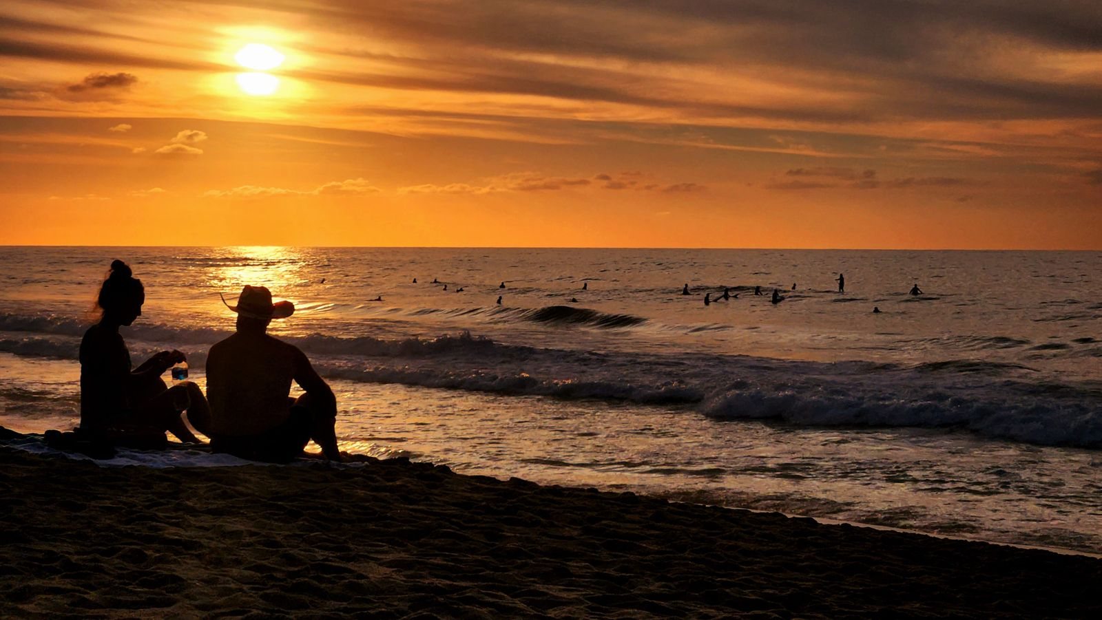 Sunset on San Pancho beach, with surfers in the water.
Sayulita vs. San Pancho
You don't have to choose. They are neighbors, and very different:
| San Pancho | Sayulita | |
|---|---|---|
| Vibe | Quiet, artsy | Lively, bohemian |
| Beach | Wide, fewer people | Central, busy |
| Best for | Relaxing, walks, sunsets | Surfing, shopping, food, nightlife |
The best plan is to see both in one day. For the other half, read things to do in Sayulita and our guide to Riviera Nayarit beach towns.
Suggested San Pancho Itinerary
Half day: start at the square and church, walk down Avenida Tercer Mundo past the murals and warehouses, and finish with a couple of hours on the beach. If you are traveling on your own, pair it with Sayulita in the afternoon.
Full day: have breakfast in town, explore the warehouses and galleries in the morning, grab some seafood for lunch and save the afternoon for the beach. Stay for sunset, the best moment of the day in San Pancho. If you are there on a Tuesday, ask about the artisan market in the square.
San Pancho and Sayulita Tour from Puerto Vallarta
Our Sayulita & San Pancho tour starts in San Pancho, with a visit to the square, the historic church and free time at the beach. Then it continues to Sayulita for a guided walk and free time. It runs Tuesday, Thursday and Saturday. It is a full-day tour offered in English and Spanish, and it includes:
- Round-trip transportation in a van (17 people maximum)
- Certified tour guide
- Tasting of regional Mexican candy
- Visit to San Pancho's main square and beach
- Guided walking tour of downtown Sayulita and free time
- 1 or 2 bottles of water
Lunch is not included. Optional surf lessons are available at an extra cost, with a 50% discount for tour guests.
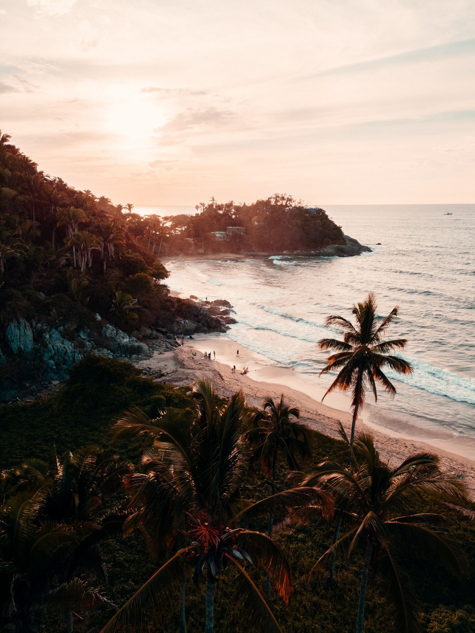 Sunset on the coast at San Francisco (San Pancho), Nayarit.
Tips for Your Visit to San Pancho
- What to pack: biodegradable sunscreen, a hat, a towel, sunglasses, water and comfortable shoes for the cobblestones.
- Carry cash for small shops, stalls and markets; not everyone takes cards.
- Follow beach warnings about surf conditions and never swim alone.
- Budget: there are no big resorts in town; options range from simple food stands to more polished restaurants, so you can spend as much or as little as you like.
- Getting around: the town is easy to explore on foot.
- Be a good guest: people live here year-round. Keep the noise down, pack out your trash and ask before photographing people, artisans or spaces with children, such as the circus or Entreamigos.
- Protect wildlife: stay away from marked turtle nests and skip the flash on the beach at night.
FAQ
Are San Pancho and San Francisco the same place? Yes. The official name is San Francisco; San Pancho is the nickname everyone uses.
How far is San Pancho from Sayulita? Very close, about 5 km (3 miles) on Federal Highway 200, just a few minutes' drive.
Which is better, Sayulita or San Pancho? It depends on what you want: San Pancho for peace and quiet, Sayulita for energy. Our tour lets you see both.
Why is the main street called Tercer Mundo (Third World)? It comes from President Luis Echeverría's 1970s project to make San Pancho a model town for developing nations, then known as the Third World.
When is the San Pancho festival? The patron saint festival for Saint Francis of Assisi runs from late September and peaks on October 4. Check each year's program.
Can you swim in San Pancho? Yes, with caution. It is open ocean, with strong surf and currents at times. Check conditions and flags before going in.
What is the best time to visit San Pancho? November to May, the dry season. June to October is rainier, but there are fewer people and the jungle is at its greenest.
Photos: Vladimir Miranda / Pexels License via Pexels · Luisalvaz / CC BY-SA 4.0 via Wikimedia Commons · John Henry / Pexels License via Pexels · Vladimir Miranda / Pexels License via Pexels