At the northern tip of Banderas Bay, Punta Mita has a reputation for five-star resorts and private golf courses. But right next to that gated world is a laid-back fishing village with an open beach, gentle surf for beginners and boats heading out to the Marietas Islands. Behind the postcard is a story few visitors hear: a settlement founded by a shark fisherman in the 1940s that, half a century later, was moved to make way for one of Mexico's most exclusive resort developments. Here is the history, plus how to make the most of Punta Mita on a day trip from Puerto Vallarta.
Punta Mita vs. Punta de Mita: What's the Difference?
The two names sound almost identical, and travelers mix them up all the time:
- Punta Mita (no "de") is the private resort development covering the tip of the peninsula, roughly 1,500 acres of luxury hotels, residential communities and golf. Access by land is restricted. Unless you are staying there or have a reservation, you generally won't get past the gate.
- Punta de Mita (with "de") is the town, made up of Corral del Risco and Emiliano Zapata. This is where you'll find El Anclote beach, fishing boats, beachfront palapas and quiet streets, and anyone can visit.
Both are in the municipality of Bahía de Banderas, in the state of Nayarit, about an hour north of downtown Puerto Vallarta. The village is small but growing: Corral del Risco had 605 residents in 1990 and 2,564 in the 2020 census.
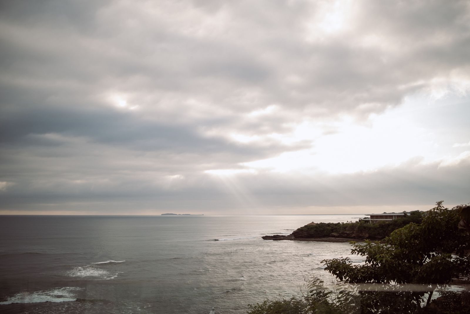 A cloudy sunset over the Punta Mita coastline.
Punta Mita History: From Shark-Fishing Camp to Luxury Destination
Before the Spanish
People have lived on this peninsula for a long time. A hilltop archaeological site here has been dated to around 800 AD, and the municipality's official profile describes a ceremonial site in Punta de Mita, Loma Cayero, with a group of three stone sculptures. Burials in large pottery urns and shaft tombs, a funeral tradition typical of West Mexico, have also been found in the region.
One intriguing clue links this coast to northern Mexico. In 1972, archaeologist Charles Di Peso, best known for his excavations at Casas Grandes (Paquimé) in Chihuahua, wrote a report on Punta de Mita. His lead was a tiny sea snail, Persicula bandera, which at the time had only been found alive near La Cruz and Bucerías, and as an artifact at Casas Grandes. Di Peso suggested this coast may have had direct ties to that city before 1060 AD. It remains a hypothesis, not a proven fact, but it hints at how far trade networks reached in ancient Mexico.
How Banderas Bay Got Its Name
According to tradition recorded by colonial chroniclers, when Francisco Cortés de San Buenaventura, a nephew of Hernán Cortés, arrived in 1524 or 1525 (sources disagree on the year), local people greeted him carrying small banners of colorful feathers. Together with the Spanish standards, it looked like a sea of flags, and the place became known as the Valle de Banderas, the "Valley of Flags." The town there was Tintoc, seat of a small chiefdom within the old kingdom of Xalisco. Over time the name spread to the whole bay, which in the 18th century served as a shelter for ships sailing to San Blas and Acapulco. For the other side of the bay, read our Puerto Vallarta history.
And "Mita"? Travel and real estate sites often claim it comes from the Nahuatl word Mictlan, translated as "gateway to paradise." In fact, Mictlan was the Aztec land of the dead, and we found no scholarly source backing the link. Treat it as folklore.
The Birth of Corral del Risco
The village has a founder with a name and a trade. According to researcher Maribel Real Carranza of Mexico City's Instituto Mora, Corral del Risco began in 1942, when Aurelio Solís Verde, a shark fisherman, started coming here seasonally. There were no roads, so everything moved by sea; in 1947 he settled with his family in a palm-thatched house. The name refers to the shape of the cove, a natural "corral" of rocks that sheltered the boats.
In 1954 a dirt road opened, and more fishing families arrived from the region and from Jalisco. Public transportation started in 1981, and the road was paved in 1985. Growth was slow: 7 residents in 1970, 91 in 1980 and 479 in 1990, according to that research. Most people fished for red snapper, shark and lobster, or took visitors out to the Marietas by boat.
The Trust, the Megaproject and the Relocation
The turning point came on paper. On November 10, 1970, a presidential decree expropriated more than 4,000 hectares (about 10,000 acres) from eight ejidos, or communal landholdings, along the Nayarit coast for tourism development. The Higuera Blanca ejido, which included Corral del Risco, lost 1,083 hectares, and the land went to a federal trust, the Fideicomiso Bahía de Banderas. In December 1989, the municipality of Bahía de Banderas was created, split off from Compostela.
In 1990, the Nayarit government discussed an ecological master plan with the Cousteau Society, including a possible dolphin research center, but the idea went nowhere. In 1991, the trust sold the land from the village to Destiladeras beach to a company called Costa Banderas, which agreed to build a new town for residents. Many refused to leave, and years of conflict followed, with lawsuits, demolished homes and arrests of fishermen. In September 1994, the last families left. Residents were moved about two kilometers (just over a mile) to what is now Nuevo Corral del Risco.
In 1999, a luxury hotel from an international chain opened on the point, and the "Punta Mita" brand took off. That history, still remembered locally, is why the village and the resort ended up with nearly the same name.
Punta Mita Timeline
- c. 800 AD: the hilltop archaeological site is occupied.
- 1524–1525: Francisco Cortés de San Buenaventura arrives; the name Valle de Banderas is born.
- 1942: Aurelio Solís Verde starts fishing out of Corral del Risco.
- 1954: a dirt road reaches the village.
- 1970: expropriation decree and creation of the Bahía de Banderas trust.
- 1989: the municipality of Bahía de Banderas is created.
- 1991: the village land is sold for the Costa Banderas megaproject.
- 1994: the relocation to Nuevo Corral del Risco is completed.
- 1999: a luxury hotel from an international chain opens in Punta Mita.
- 2005: the Marietas Islands become a national park.
- 2016: Hidden Beach closes temporarily due to coral damage.
- 2019: La Lancha beach, fenced off since 2016, reopens to the public.
Things to Do in Punta Mita
Spend the Day at El Anclote Beach
El Anclote is the village beach and the hub for almost everything: boat departures, surf lessons, board and paddleboard rentals. The waves here tend to be long and soft. Under Mexican law, beaches are public property, and access to them is protected.
Surf or Take Your First Lesson
Punta Mita is one of the best-known surf areas on the Riviera Nayarit, because it picks up swell from different directions throughout the year. A few popular breaks:
- El Anclote: a slow, long right-hander that is a favorite for beginners and longboarders. It usually works best at low tide.
- Stinky's: close to El Anclote and also recommended for beginners and longboards.
- La Lancha: a beach reached by boat or by a long walk; it gets crowded on weekends. It was fenced off in 2016 until, in November 2019, Mexico's environment ministry (Semarnat) revoked the concession and reopened it. Check current access before you go.
- El Faro and Burros: more powerful waves, better for experienced surfers.
Winter and spring bring north and northwest swells, often with clean conditions; summer brings south swells, usually smaller and good for learning. If you've never surfed, book a lesson with an instructor and ask about the day's conditions. To compare, see our guide to surfing in Sayulita.
Take a Boat to the Marietas Islands
Boats leave from the village for the Marietas Islands, roughly 8 km (5 miles) offshore, about a 15-minute ride. These uninhabited volcanic islands became a national park in 2005 and a UNESCO Biosphere Reserve in 2008, and they are managed by CONANP, Mexico's protected areas agency.
In the early 1900s, the Mexican government used the islands for military testing; popular accounts say the blasts helped carve their caves. In the late 1960s, Jacques Cousteau joined the calls to protect them. Today they are a refuge for seabirds such as blue-footed boobies and brown boobies, which nest on Isla Larga.
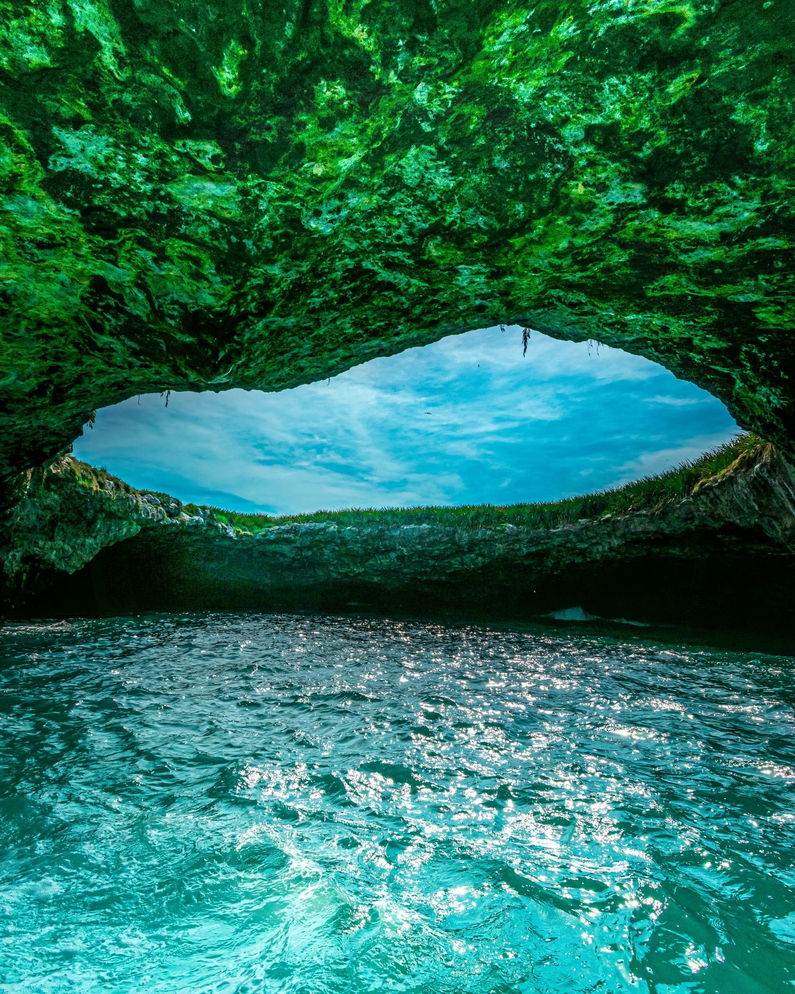 Hidden Beach (Playa del Amor) in the Marietas Islands, seen from inside the cave.
The famous Hidden Beach (Playa del Amor) has a limited number of daily visitors and strict rules: you can only go with a CONANP-authorized operator, time on the beach is short, life jackets are required, fins are not allowed, and a conservation fee applies. In 2016 it closed for several months because crowds were damaging the coral. Not every Marietas trip includes access to the beach itself. Rules, operating days and capacity can change, so confirm the current rules before you book. Learn more in our Marietas Islands guide.
Go Whale Watching in Season
Every winter, humpback whales come to Banderas Bay to mate and give birth. The season runs roughly from December through March, sometimes into early April, and January and February are usually the best months. Only the males sing, and some tours carry a hydrophone so you can hear them.
Choose an operator permitted by Semarnat: the official standard NOM-131 sets rules on distance, time and speed around the whales. For the 2025–2026 season, the official notice designated restricted zones in a 2 km (1.2-mile) strip along the coast from Punta Mita to the mouth of the Ameca River, and within 1.5 km (about 1 mile) of the Marietas. Check each season's notice, and read our whale watching guide.
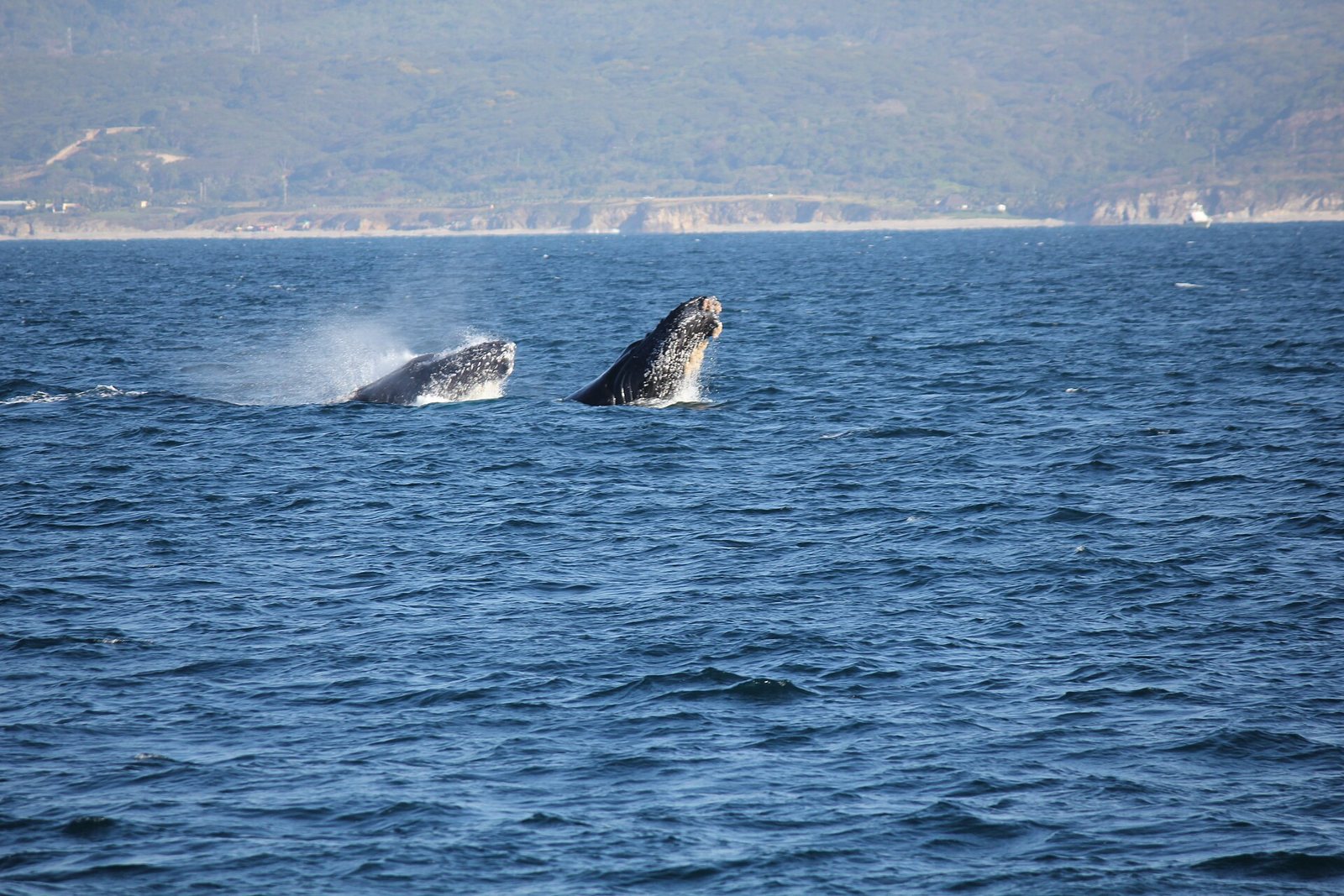 Humpback whales in Banderas Bay near the Marietas Islands during the winter season.
Eat Fresh Seafood on the Beach
The beachfront palapas in town serve what the local boats bring in. Traditional Bahía de Banderas cooking has its own specialties: fish or shrimp embarazado, skewered on a stick and grilled over charcoal; lobster; and soporrondongo, a small fried tamal of fresh corn masa eaten at harvest time. Read about fish on a stick, pescado zarandeado, and where to eat in Bucerías and Punta Mita.
Punta Mita Weather and Nature
The Bahía de Banderas climate is warm and semi-humid, with average annual temperatures of roughly 73–82°F (23–28°C) and sunshine most of the year. Rain falls mainly from June through September, and the eastern Pacific hurricane season runs from May 15 to November 30.
- December to April: dry, high season, with whales and north swells.
- May and June: hotter, calmer seas and fewer people.
- July to October: afternoon rain, lush green hills, south swells and sea turtle nesting season on the Nayarit coast.
Palms, wild fig trees and mangroves line the coast, while the forest inland includes huanacaxtle (guanacaste), capomo and primavera trees.
Local Culture: San Isidro in Higuera Blanca
A few minutes from the village is Higuera Blanca, the ejido Corral del Risco once belonged to. Its patron saint is San Isidro Labrador, and in mid-May the festivities usually include a horseback procession toward Punta de Mita, a blessing of riders in front of the church, a festival queen, brass banda music and a rodeo-style jaripeo. Dates and programs change every year, so confirm locally if you'd like to see it.
How to Get from Puerto Vallarta to Punta Mita
Punta de Mita is about 45 km (28 miles) from Puerto Vallarta. By car, plan on 45 minutes to an hour, depending on traffic:
- Take Highway 200 north, through Nuevo Vallarta and Bucerías.
- Just after Bucerías, take the exit toward La Cruz de Huanacaxtle and Punta de Mita and follow the coastal road.
Highway 200 is two lanes in many stretches, so leave some buffer time. Public buses also run north along Highway 200 toward the Nayarit coast; check the current route and stop before heading out. Good to know: even though you're in Nayarit, Bahía de Banderas runs on Central Time, the same as Puerto Vallarta. Passing through Nuevo Vallarta? See our Nuevo Vallarta guide.
Practical Guide: Itinerary, Packing and Budget
- Half day: reach El Anclote by mid-morning, take a surf lesson at low tide and finish with seafood by the water.
- Full day: Marietas boat trip in the morning, when the sea is usually calmer (with whales in season), then lunch in the village and sunset at El Anclote.
- What to pack: reef-safe sunscreen, a hat, a rash guard or long-sleeve shirt, water, Mexican pesos in cash and a dry bag for the boat.
- Budget: the village and beach are free; your main costs are the Marietas trip (plus the conservation fee if you land on Hidden Beach), surf lessons and food. Ask exactly what each trip includes before you pay.
- Etiquette: ask before photographing people, don't climb on beached boats, pack out your trash, never touch or take coral, and wait your turn in the lineup.
Nearby Day Trip: Sayulita and San Pancho with Riviera Tours & Transfers
Our tour does not go to Punta Mita, but if you want to explore more of the north shore, the Sayulita and San Pancho tour visits two neighboring beach towns known for their surf vibe and local character. It runs Tuesday, Thursday and Saturday. It is a full-day tour in English and Spanish, with a maximum of 17 guests, and it includes:
- Round-trip transportation
- Certified tour guide
- Tasting of traditional Mexican sweets
- Visit to San Pancho's town square and beach
- Guided walking tour of downtown Sayulita
- Free time in Sayulita
- Bottled water
Optional: surf lessons at an extra cost, with a 50% discount for tour guests. Lunch is not included.
See dates and book the Sayulita and San Pancho tour →
Planning more of the coast? Read our guides to things to do in Sayulita, San Pancho and the Riviera Nayarit beach towns.
Tips for Visiting Punta Mita
- Arrive early on weekends and in high season; El Anclote fills up.
- Use reef-safe sunscreen, especially if you're going to the Marietas or swimming near reefs.
- Follow lifeguard flags and instructions; conditions change with the tide.
- Check the latest CONANP rules before booking an island trip.
FAQ
Is Punta Mita the same as Punta de Mita? No. Punta Mita is the private resort and residential development at the tip of the peninsula, with restricted access. Punta de Mita is the public fishing village (Corral del Risco), home to El Anclote beach.
Can you visit Punta Mita without staying at a resort? You can visit the village and El Anclote beach freely. Entering the private Punta Mita development by land generally requires a reservation.
Can you go to Hidden Beach from Punta Mita? Yes, boats to the Marietas Islands leave from the village, but Hidden Beach has a daily visitor cap and is only accessible with CONANP-authorized operators. Make sure your trip includes beach access and check the current rules.
When is whale season in Punta Mita? Roughly December through March, with some sightings into early April. January and February are usually the best months.
Is Punta Mita good for beginner surfers? Yes. El Anclote and Stinky's have soft, long waves that are popular for lessons and longboarding. El Faro and Burros are for experienced surfers.
What is the best time to visit Punta Mita? December through April is dry and whale season, but also the busiest. If you don't mind the heat and want fewer crowds, May and June are a good option.
What time zone is Punta Mita in? The same as Puerto Vallarta. Although it's in Nayarit, the municipality of Bahía de Banderas uses Central Time.
Photos: Colleen Irwin / Pexels License via Pexels · Angel Ayala / Pexels License via Pexels · Jorge Medina / Pexels License via Pexels · terri_bateman / CC BY 2.0 via Wikimedia Commons