Most visitors to Puerto Vallarta never realize how close the mountains are. Drive a little over an hour inland, climb into the pine forests above the old mining town of San Sebastián del Oeste, and on a clear day you can look all the way back down to Banderas Bay. That viewpoint is Cerro de La Bufa, and it is one of the best ways to understand how tightly the Sierra hugs this stretch of the Pacific coast.
The view is only half the story. The road up crosses what was once a colonial silver district, passes a church that has stood for roughly three centuries, and climbs through forests that botanists describe as a refuge for plants found nowhere else on Earth. This guide covers all of it: the history, the nature, and how to plan the trip.
Not the One in Zacatecas: Which Cerro de La Bufa Is This?
Search for "Cerro de la Bufa" and you will mostly find the famous hill in Zacatecas, in north-central Mexico. Standing about 2,600 m (8,560 ft) above the state capital, it is where Pancho Villa's División del Norte won the Battle of Zacatecas on June 23, 1914. Today it has a cable car, a museum and equestrian statues of the victorious generals. There is also a well-known Bufa above Guanajuato city, popular with hikers.
This guide covers Cerro de La Bufa in San Sebastián del Oeste, Jalisco: a forested peak about 9 km (5.5 miles) from town, with no cable car or museum, just a rough road, a short trail and a huge view. Visit Mexico calls it probably the best-known of the peaks around the town.
Why Are So Many Hills Called "La Bufa"?
For the Zacatecas hill, the most popular story says the Spanish named it for its shape, using a word usually linked to "pig's bladder" (some sources trace it to Aragonese, others to Basque, and another version says "wineskin"). None of these explanations is fully proven, and we found no document explaining how the San Sebastián hill got its name. What is clear is that the name turns up in several of Mexico's old mining regions.
Cerro de La Bufa at a Glance
- Elevation: Mexican tourism guides put the summit at roughly 2,400 meters (about 7,900 feet), most often quoted as 2,411 m. The town itself sits around 1,480 m (about 4,850 ft), so you gain a lot of altitude on the way up.
- Distance from San Sebastián: about 8.5–9 km, roughly a 30-minute drive.
- Final stretch: around a 15-minute walk from where vehicles stop, depending on your fitness.
- On the way: the tiny village of Real Alto, home to a small 17th–18th century church dedicated to the Virgen del Rosario.
- Not the highest point: the municipality ranges from about 60 m to roughly 2,560 m (8,400 ft).
- Services: none at the summit; very basic ones in Real Alto.
The View: Banderas Bay from the Sierra
The reason to make the trip is the panorama. On one side, forested ridges roll off into the distance. On the other, when the sky is clear, you can pick out Banderas Bay and the Pacific, and some sources say even the Puerto Vallarta area.
The beach and the mountains are practically neighbors. According to Jalisco's state statistics and geography institute (IIEG), close to 80% of the municipality has slopes steeper than 15 degrees, and from the summit you can see why: ridge after ridge folding down toward the sea.
A word of honesty, though: the summit is often wrapped in clouds. Some days you will not see the ocean at all and will instead stand above a sea of mist, which is beautiful in its own way. Nobody can promise you the bay view.
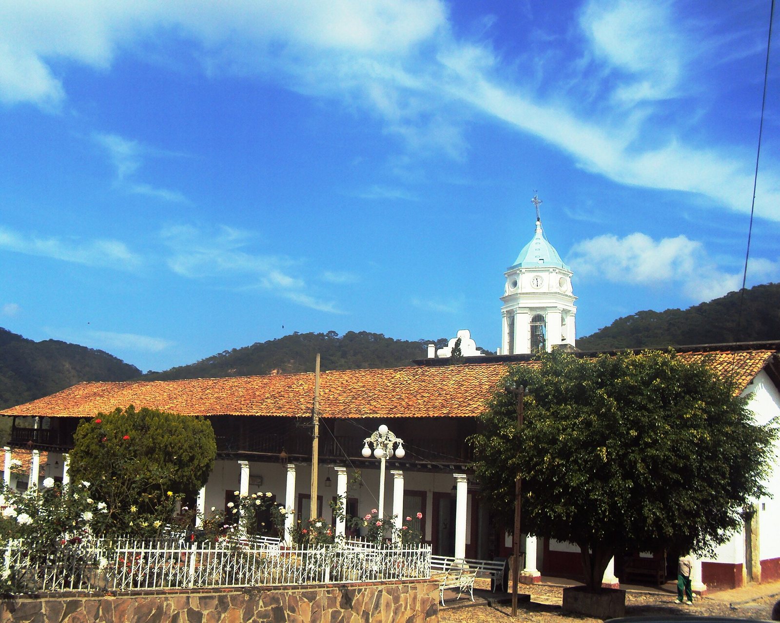 The San Sebastián church and town park, with the forested Sierra behind them.
The History Around La Bufa
Before the Mines
According to the municipal history compiled by the IIEG, the area was home to people colonial sources call the Tecos before the Spanish arrived. The conquest of the region is dated to 1524, and in 1530 the expedition of the conquistador Nuño de Guzmán passed through and took control of what had already been conquered.
A Royal Mining Camp
Mines were discovered in the area in 1542, and the town of San Sebastián was formally founded in 1605. In colonial times it was known as the Real de San Sebastián; a real was what the Spanish called a mining settlement. That is where the town's nickname, "El Real," comes from, and it also explains the name of Real Alto, the hamlet you pass on the way to La Bufa.
The wealth came from veins of silver, gold and lead. By 1785 the district had close to 30 mines and about ten haciendas de beneficio, where ore was processed. San Sebastián was granted city status in 1812. The boom lasted into the early 20th century; after the 1910 Revolution and the closing of the mines, people left and the town was left almost frozen in time. Today about 600 people live there (632 in the 2020 census).
Real Alto and Its Church
Real Alto is a small community on the road to La Bufa. Its church, built between the 17th and 18th centuries, keeps its colonial architecture and houses a neoclassical wooden altarpiece; the main altar holds the image of the Virgen del Rosario del Real Alto (Our Lady of the Rosary). A parish archive inventory published by the Mexican archive-preservation group Adabi describes Real Alto as a witness to colonial-era mining, while the main town reflects later boom years. The municipality celebrates the Virgen del Rosario every October 7.
The Bay You See Once Belonged to San Sebastián
This is the fact that surprises visitors most. The port you can spot from the top was born largely to serve these mines: Las Peñas de Santa María de Guadalupe, founded on December 12, 1851, supplied salt to the mining camps in the Sierra, which used it to process silver. In 1888 the Las Peñas district was annexed to the municipality of San Sebastián, and only in 1918 did it become its own municipality, today's Puerto Vallarta. For about 30 years, then, the bay you see from La Bufa was governed from the mountain town. We tell the full story in our Puerto Vallarta history and San Sebastián del Oeste mining history guides.
Timeline
- 1524: Spanish conquest of the region, then home to the Tecos.
- 1542: Mines discovered.
- 1605: The Real de San Sebastián is founded.
- 17th–18th centuries: The Real Alto church is built.
- 1785: Close to 30 mines and about 10 processing haciendas in the district.
- 1812: San Sebastián is granted city status.
- 1851: Las Peñas (today Puerto Vallarta) is founded and ships salt to the mines.
- 1888: Las Peñas becomes part of the San Sebastián municipality.
- 1918: Puerto Vallarta becomes its own municipality.
- 1983: The municipality officially adopts the name San Sebastián del Oeste.
- 2011: San Sebastián del Oeste is named a Pueblo Mágico.
Nature on Cerro de La Bufa
Many people come for the view and leave talking about the forest. As you climb, the landscape changes.
From Scrub to Pine-Oak Forest
A garden writer who hiked up from town described a first stretch of open, sometimes damp woodland with wild relatives of familiar garden plants: salvias, cupheas, solanums and senecios. Higher up, the ground gets drier and windier, carpeted with foot-long pine needles, and you enter an open pine-oak forest with several kinds of oak, madrones and agaves. The pines are draped with bromeliads, lichens and orchids.
A Refuge for Rare Plants
A 2020 study in the journal Acta Botanica Mexicana compiled 407 vascular plant species and varieties in the municipality and found that 332 fall into at least one conservation-risk category. Ninety-four are endemic to western Mexico, 31 are known only from Jalisco, and six are micro-endemics found only in this municipality. The authors call it an important reservoir of endemic and threatened plants.
The municipality holds conifer forest, oak forest, cloud forest, and subtropical and tropical dry forest, across an elevation range of about 300 to 2,500 m, according to a University of Guadalajara fungi survey.
Mushroom Season
That same survey, published in 2019, recorded 311 kinds of fungi in the municipality. Pine-oak forest was the richest habitat, followed by cloud forest, and Amanita was the genus with the most species. Researchers collected during the rainy season, June through September, when the forest floor comes alive with mushrooms. One important tip: never pick or eat wild mushrooms; several Amanita species are highly toxic and only an expert can tell them apart.
How to Get to the Top of La Bufa
Access is by a dirt road that leaves San Sebastián and passes through Real Alto. It is not a road for a regular rental car. Most people go up in a 4x4 vehicle or on an ATV, and tourism sources recommend going with a certified local guide who knows current road conditions. From the end of the road, a short dirt-and-rock trail takes you to the summit.
If you prefer to earn the view, you can also hike up from town: a demanding climb with significant elevation gain through several types of forest, and the best way to notice the plants and wildlife. Start early, carry plenty of water and let someone know your route.
Either way, the road changes with the rains. Check current conditions in San Sebastián before heading up.
Best Time of Year for Clear Views
In this part of Mexico, the rainy season generally runs June through October, and the drier months run November through May. The IIEG classifies most of the municipality's climate as semi-warm and subhumid, with summer rains and roughly 1,100–1,200 mm (43–47 in) of precipitation a year. For better odds of clear skies and a drier dirt road, plan your visit for the dry season.
During the rainy months the forest is lush and it is mushroom season, but fog is more common and the road can turn muddy. In any season, expect the summit to feel cooler than town, and it can be windy.
Festival dates: San Sebastián is at its liveliest on January 20 (feast of Saint Sebastian, with charreadas and a traditional fair), August 15 (Virgin of the Assumption) and October 7 (Virgen del Rosario), though you will also find more visitors.
Suggested Itineraries
Half day (if you are staying in San Sebastián): head out early with a local guide, stop briefly at Real Alto to see the church, reach the summit, and be back in town by mid-morning to explore the plaza and the San Sebastián church over a cup of local coffee.
Day trip from Puerto Vallarta: doable, but tight. Between the drive, the climb and time at the top, little is left for the town itself. With only one day, you may enjoy San Sebastián more by skipping La Bufa and saving it for a return trip.
Two days (ideal): on day one, arrive, walk the historic center, visit one of the old haciendas and try the local food. Sleep in town and head up La Bufa early the next morning. Get ideas from our guides to San Sebastián's haciendas and rural tourism and San Sebastián del Oeste coffee and food.
Budget: the main cost is the 4x4 or ATV with a guide, which usually works out better per person in a group. Bring cash; many places in the mountains don't take cards.
Safety, Etiquette and What to Bring
- Go with a local guide if you don't know the road or don't have a suitable vehicle.
- Bring a jacket or windbreaker, even if it is hot back in Vallarta.
- Wear shoes with good grip; the last stretch is dirt and loose rock.
- Expect little or no cell signal in the mountains. Download offline maps before you go.
- Pack water, sunscreen and snacks. There are no services at the summit, and only very limited services in Real Alto.
- Pack out your trash, stay on the trail and don't pick plants: many species here are protected or exist nowhere else.
- Respect the people of Real Alto: it is a living village, not a museum. If you step into the church, keep quiet, dress modestly and don't interrupt services. Ask before photographing people.
See San Sebastián del Oeste with Riviera Tours & Transfers
To be clear up front: our tour does not go up to Cerro de La Bufa. But if you want to experience San Sebastián del Oeste itself without driving mountain roads, our San Sebastián del Oeste tour is an easy way to do it. It runs Monday, Wednesday and Friday, it is a full-day tour, and it is offered in English and Spanish. It includes:
- Round-trip transportation
- Certified tour guide
- Visit to an artisanal tequila gallery
- Organic coffee factory tour
- Lunch and aguas frescas at a traditional Mexican restaurant
- Guided walking tour of downtown San Sebastián
- Free time to explore on your own
- Bottled water during the tour
Good to know: many places in town accept cash only, cell signal is limited, and because of the cobblestones and slopes, the tour is not recommended for wheelchair users. If you fall in love with the town, you can always come back and plan a trip up La Bufa.
See dates and book the San Sebastián del Oeste tour →
Planning more of your trip? Read our San Sebastián del Oeste travel guide, our San Sebastián del Oeste to the coast route and our list of things to do in Puerto Vallarta.
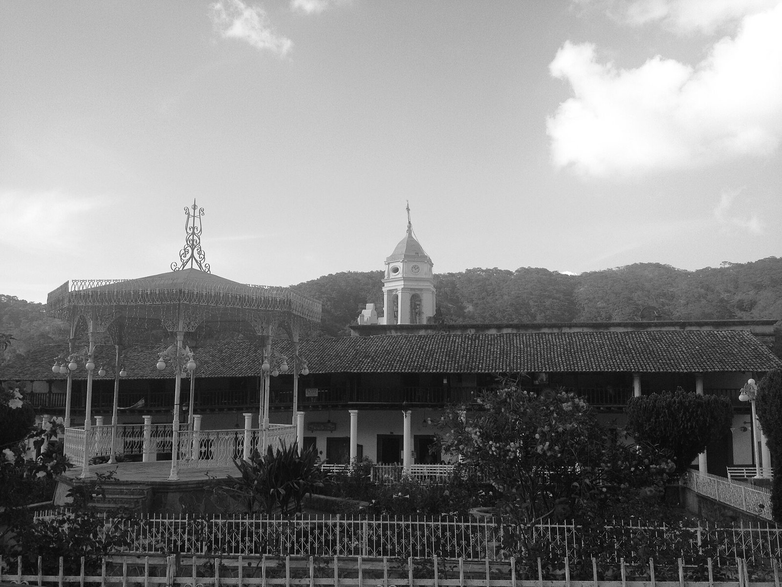 The main square of San Sebastián del Oeste, the starting point for exploring town.
FAQ
How high is Cerro de La Bufa in San Sebastián del Oeste? Tourism guides list it at roughly 2,400 meters (about 7,900 feet) above sea level, most often as 2,411 m.
Can you really see the ocean from La Bufa? Yes, on clear days you can see Banderas Bay. But the summit is frequently covered in clouds, so the view is never guaranteed.
Can I drive up in a regular car? It is not recommended. The road is unpaved; most visitors go in a 4x4, on an ATV or on foot, ideally with a local guide.
Is this the Cerro de La Bufa from the Battle of Zacatecas? No. That hill, site of the 1914 battle, is in the city of Zacatecas. This one is in the Jalisco Sierra, about 9 km from San Sebastián del Oeste.
When is the best time to go? The dry season, November through May, gives you better odds of clear skies and a drier road. The rainy months are greener but foggier and muddier.
What is Real Alto? A small village on the road to La Bufa with colonial mining roots and a 17th–18th century church dedicated to the Virgen del Rosario.
Is there an entrance fee? We found no official published fee. Your main cost is transportation or a guide. Ask in town about current conditions.
Does the Riviera Tours & Transfers San Sebastián tour include La Bufa? No. The tour covers the town, a tequila gallery, an organic coffee factory and lunch, but it does not go up the mountain.
Photos: Intersofia / CC BY-SA 3.0 via Wikimedia Commons · Mechitas / CC BY-SA 3.0 via Wikimedia Commons · Aldair546 / CC BY-SA 4.0 via Wikimedia Commons