In under two hours you can trade the pine forests and morning mist of an old mining town for palm trees and the waves of Banderas Bay. The drive between San Sebastián del Oeste and Puerto Vallarta is more than a scenic road. It follows the same link that for centuries tied the silver mines of the Sierra Madre to the coast: silver came down, salt went up, and Puerto Vallarta was born in between.
Below you'll find the road stage by stage, how the landscape changes as you climb, the salt-and-silver story and the people behind it, a timeline, and practical tips for doing the trip on your own or with a guide.
Puerto Vallarta to San Sebastián del Oeste at a glance
San Sebastián del Oeste sits at about 1,480 meters (roughly 4,850 feet) in the Sierra Madre Occidental. Puerto Vallarta is at sea level. Between them lie roughly 60 to 70 kilometers (about 37 to 43 miles) of mountain road, depending on the source, and the drive usually takes between an hour and 15 minutes and an hour and a half, depending on traffic, stops and weather.
The main road is State Highway 544, which links Mascota with Puerto Vallarta and passes San Sebastián on the way. Heading down to the coast, it runs through small towns such as La Estancia and Las Palmas, and also crosses Ixtapa, before reaching Las Juntas, on the Puerto Vallarta side, where it meets Federal Highway 200, the coastal highway.
Coming from the beach, you simply do it in reverse and climb. Little by little the air cools and the hills fill with forest.
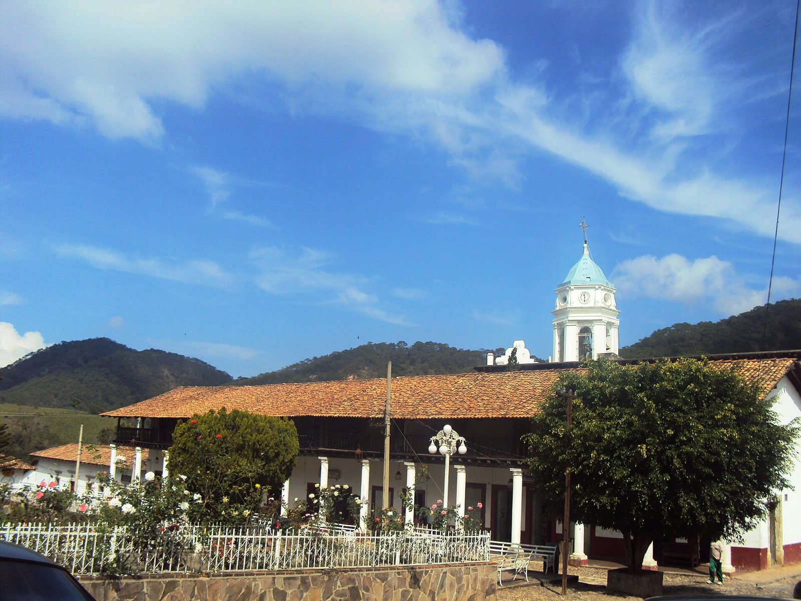 The San Sebastián church and the arcades downtown, where the route begins in the mountains.
The drive, stage by stage
- Las Juntas. This is where you leave the coast. In October 2025 the Las Juntas interchange opened here, an overpass where Federal 200 meets State 544, so the turnoff looks different than it did a few years ago.
- Ixtapa and Las Palmas. Highway 544 passes through valley towns like these, still in the coastal heat. Leave with a full tank and plenty of water: the mountains are a land of small villages.
- The climb. Past Las Palmas the road starts gaining altitude through tight curves with ravines on either side. This is where the scenery changes fastest. Several guides point to the El Progreso bridge as a good place to take in the ravine.
- La Estancia and the turnoff. Up in the mountains, the highway keeps going toward Mascota, and further on you'll find the turnoff to town.
- Arrival. San Sebastián sits in narrow river valleys, including that of the Los Reyes River, and a 19th-century bridge leads into town, according to Mexico News Daily.
A true mountain road: what to expect
Expect tight curves, deep ravines and long stretches of thick vegetation. The road long had a reputation as a tough drive, especially in the rainy season, when landslides were common. In 2020 the Jalisco state government announced it had finished renovating the roughly 96-kilometer Mascota–Puerto Vallarta road, saying the full trip between the two now took about 75 minutes. Even so, the final stretches into town are narrow and winding.
If you plan to drive yourself:
- Drive in daylight. The curves and fog are harder at night.
- Check road conditions before you go, especially from June to October, the region's rainy season.
- Don't count on cell service in the mountains. Download your map ahead of time.
- Don't stop on curves to take photos.
From tropical forest to cloud forest: nature along the route
The most remarkable thing about this drive is that in just over an hour you pass through several ecosystems.
On the coast, Puerto Vallarta has a warm, humid tropical climate (Köppen type Aw), with an average annual temperature of about 26 °C (79 °F) and rains from mid-June to mid-October. The hills around the bay are covered in tropical forest, with wild figs, parota (guanacaste) and amapa trees.
On the climb, generally speaking, tropical forest gives way to oak and then pine. A University of Guadalajara fungi survey describes conifer forest, oak forest, cloud forest, and medium and low tropical forest in the municipality of San Sebastián, from about 300 to 2,500 meters. In other words, the whole route, from valley floor to summit, fits inside a single municipality.
In the mountains, pine-oak forest dominates, and in humid pockets you find cloud forest with Jalisco fir, magnolias and tree ferns. A study published in Acta Botanica Mexicana in 2021 recorded 407 vascular plant species in the area's cloud forest, 94 of them endemic to western Mexico. Deer, peccaries, coyotes, parrots and hummingbirds live here. According to Jalisco's statistics and geography institute (IIEG), about 70% of the municipality lies within a federal protected area, and its average annual temperature is around 19.5 °C (67 °F).
The bay view from Cerro de La Bufa
The one spot where you can see the mountains and the sea together is Cerro de La Bufa, about 9 kilometers from town and roughly 2,400 meters (about 7,900 feet) high, according to travel guides. On clear days you can make out Banderas Bay from the top, often with clouds below you. The way up is a dirt road, usually by 4x4 or ATV, with a short final stretch on foot. Fog tends to clear early, so mornings are best.
Our Cerro de La Bufa lookout guide covers how to get up there.
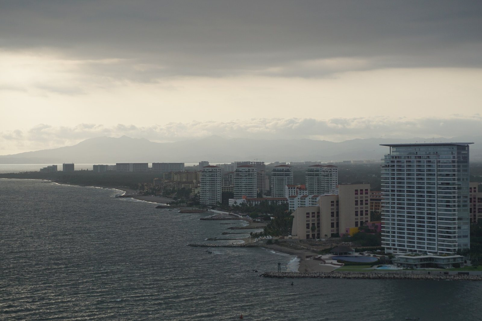 The mountains rise right behind the Banderas Bay shoreline, seen from Puerto Vallarta.
Salt for the silver mines: the history that links mountains and sea
According to the IIEG, mines were already being discovered in the region by 1542, and in 1605 the San Sebastián mines were found and the town was founded. Silver drove the regional economy, along with towns like Mascota, which Puerto Vallarta's tourism board describes as one of Jalisco's largest towns in the 18th century and a farming center that supplied the mines. By 1785, according to Mexico's submission to UNESCO, San Sebastián had close to 30 mines and about ten ore-processing haciendas.
Why silver needed salt
To separate silver from rock, much of New Spain used the patio process, developed by Bartolomé de Medina in Pachuca in 1554: crushed ore was mixed with water, mercury, common salt and a copper compound, then worked for weeks in large open courtyards. We don't know which method each San Sebastián hacienda used, but the sources agree on the key point: the mines needed salt, and there was none in the mountains.
Las Peñas, the salt village
According to the traditional story, on December 12, 1851, the feast of Our Lady of Guadalupe, a salt trader named Guadalupe Sánchez Torres arrived with his wife, Ambrosia Carrillo, and other families at the mouth of the Cuale River. They called the settlement Las Peñas de Santa María de Guadalupe. Salt arrived by sea and was hauled into the mountains by mule.
The story has nuances. Puerto Vallarta's tourism board notes that Sánchez's land purchase record is dated 1859, and that fishermen and pearl divers were already in the area. That same year the Unión en Cuale mining company, partly owned by the Camarena brothers of Guadalajara, took over land from Los Arcos to the Pitillal River and back into the mountains, to supply its mines through shipping, fishing and farming. By 1885 Las Peñas had about 800 residents, and that year the port opened to national shipping with a customs house.
When Vallarta belonged to the mountains
On May 2, 1888, Las Peñas was annexed to the municipality of San Sebastián. That same year, according to the municipal history cited by Spanish-language Wikipedia, San Sebastián's miners went on strike under Felipe Preciado and Francisco Ochoa, and the mines' output was shipped out through Las Peñas. In 1918 Las Peñas became its own municipality, named Puerto Vallarta after Ignacio L. Vallarta, a lawyer and former governor of Jalisco. Jalisco's most famous beach city spent years governed from a mountain town.
A fun fact: Amado Aguirre (1863–1949), born in San Sebastián and trained as a mining engineer, sat in the Constitutional Congress of 1917 and later served as Mexico's Secretary of Communications and Public Works under Álvaro Obregón.
For more, read our San Sebastián del Oeste mining history, the history of Puerto Vallarta and our guide to the Puerto Vallarta Malecón and Old Town.
From isolation to tourism: how the 20th century changed the route
After the 1910 Revolution, many foreign mining companies left, and according to Mexico News Daily the San Sebastián mines were closed by about 1921. The town went from 2,305 residents in 1900 to 632 in the 2020 census. Ironically, that decline is what preserved its architecture.
On the coast, the economy turned to farming with the arrival of the Montgomery Fruit Company in 1925, which left after the 1935 land reform. Vallarta remained isolated, reached mostly by sea or small plane. Everything changed with the filming of The Night of the Iguana (1963), and in 1968 funding came for the coastal highway, a bridge over the Ameca River and the airport.
The same Hollywood crowd made it up the mountain: according to Mexico News Daily, Hacienda Jalisco, a 19th-century mining estate just outside San Sebastián, hosted John Huston, Elizabeth Taylor and Richard Burton. In 2001 the town was added to Mexico's UNESCO tentative list, and in 2011 it was named a Pueblo Mágico.
Timeline: mountains to sea
- 1542: first mines found in the region (IIEG).
- 1605: San Sebastián's mines discovered and the town founded.
- 1785: close to 30 mines and about ten processing haciendas.
- 1851: traditional founding of Las Peñas, the salt supplier.
- 1859: the Unión en Cuale company takes land on the bay.
- 1888: Las Peñas is annexed to San Sebastián.
- 1918: the municipality of Puerto Vallarta is created.
- Around 1921: San Sebastián's mines close.
- 1963: The Night of the Iguana is filmed in Mismaloya.
- 2011: San Sebastián del Oeste becomes a Pueblo Mágico.
- 2020: the Mascota–Puerto Vallarta road is renovated.
- 2025: the Las Juntas interchange opens.
What about Villa del Mar? The longer scenic route south
Mexican travel magazine México Desconocido suggests a "scenic route" that starts in San Sebastián del Oeste, drops down to Puerto Vallarta and keeps going south along the coast of Cabo Corrientes to Tehuamixtle Bay, where it places Villa del Mar. That leg runs through El Tuito and continues on dirt roads, so it's a multi-day trip best done in a suitable vehicle after checking road conditions.
If you'd rather go deeper into the mountains, Highway 544 continues to Mascota, and from there it's about 30 minutes to Talpa de Allende. See our guide to Mascota and Talpa de Allende.
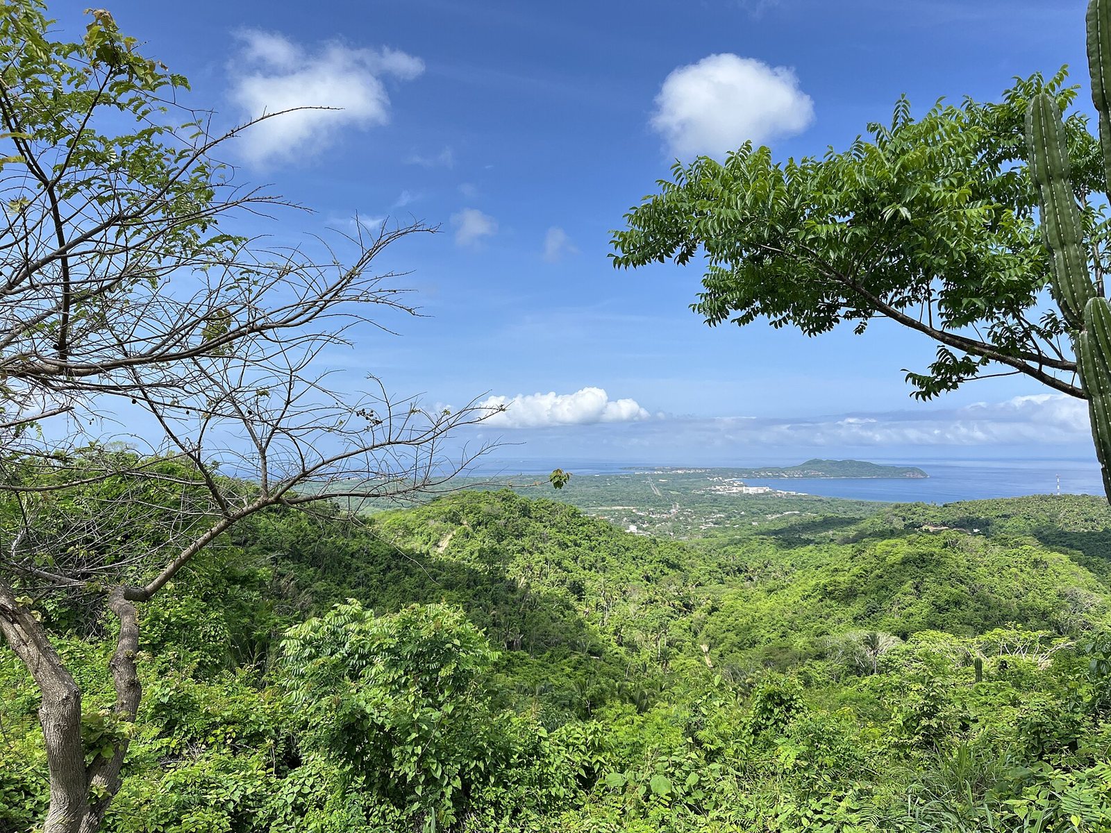 From the hills, green forest rolls all the way down to Banderas Bay.
Food and festivals at both ends of the road
In the mountains, food is made for cool mornings: pozole, birria and tamales, with shade-grown high-altitude coffee, atole and ponche, and fruit rolls and fruit cajetas for dessert. It's also raicilla country, an agave spirit that researchers say was born in mining areas like this one. More in our San Sebastián del Oeste coffee and food guide and raicilla, the Mexican agave spirit. On the coast, the sea rules: learn about pescado zarandeado.
Dates to plan around: January 20, San Sebastián's patron saint festival, with a fair and charreadas; May 31, the anniversary of Puerto Vallarta's founding as a municipality; and December 12, when the pilgrimages to Vallarta's Our Lady of Guadalupe church reach their peak.
Planning the route: itinerary, season and budget
One day on your own. Leave Vallarta early and reach San Sebastián by mid-morning. Walk the plaza, the church and the Portal del Hueso, then head back in daylight for sunset on the Malecón.
Two days. Spend a night in town so you can go up La Bufa first thing, then drive down in the afternoon.
Best time to go. November to May is drier. June to October the mountains are greener, but rain is frequent and landslides are possible.
Budget. Plan for gas for a round-trip mountain drive, a meal, and cash for coffee, sweets or crafts. On the tour, lunch is already included.
Etiquette. Say hello, ask before photographing people, and keep quiet in the church during Mass.
Take the route with Riviera Tours & Transfers
If you'd rather skip the hairpin turns, our San Sebastián del Oeste tour takes you from the coast up into the mountains. It runs Monday, Wednesday and Friday, lasts the full day and is offered in English and Spanish. It includes:
- Round-trip transportation
- Certified guide
- Visit to the Tequila Artisan Gallery
- Tour of an organic coffee factory
- Lunch and aguas frescas at a traditional Mexican restaurant
- Guided walk through downtown San Sebastián
- Free time to explore on your own
- Bottled water during the tour
The tour does not go up Cerro de La Bufa. If you want the summit view, consider spending a night in town.
See dates and book the San Sebastián del Oeste tour →
Tips for the mountains-to-sea route
- Dress in layers. It's cooler up in the mountains than at the beach, especially in the morning and in winter.
- Bring cash. Many businesses in San Sebastián only take cash.
- Wear comfortable shoes. The town's streets are cobblestone and hilly.
- Limited mobility: because of the cobblestones and slopes, the walking portion isn't recommended for wheelchair users.
FAQ
How long is the drive from Puerto Vallarta to San Sebastián del Oeste? About an hour and 15 minutes to an hour and a half on Highway 544. Rain, fog or traffic can make it longer.
Is the road to San Sebastián del Oeste safe? It's a winding mountain road with steep drop-offs. It was renovated in 2020, but drive in daylight, take it slow and check conditions during the rainy season.
Can you see the ocean from San Sebastián del Oeste? Not from town, but you can from Cerro de La Bufa on clear days.
Why are Puerto Vallarta and San Sebastián so connected? Las Peñas, the village that became Puerto Vallarta, supplied salt to the mountain mines, and from 1888 to 1918 it was part of the municipality of San Sebastián.
Why did silver mines need salt? To extract the silver: in the patio process, crushed ore was mixed with mercury and salt.
Can I continue from San Sebastián to Mascota and Talpa? Yes. Highway 544 continues to Mascota, and from there you can reach Talpa de Allende. Plan at least one extra day.
Does the Riviera tour include La Bufa or Mascota? No. The tour visits San Sebastián del Oeste; for La Bufa or Mascota you'll need to plan on your own.
For the full picture, see our San Sebastián del Oeste travel guide.
Photos: panza-rayada / CC BY-SA 3.0 via Wikimedia Commons · Mechitas / CC BY-SA 3.0 via Wikimedia Commons · Andrew Milligan sumo / CC BY 2.0 via Wikimedia Commons · El Inge MX / CC BY 4.0 via Wikimedia Commons