South of Puerto Vallarta, the coast turns into jungle, hidden coves and small fishing villages. Some of the prettiest beaches on Banderas Bay are here, and most can only be reached by boat or on foot. Here's what each one offers, how to plan your day, and the backstory most visitors never hear: a 1930s land grant, a Hollywood director who moved to a roadless cove, and mountains that send their rivers straight into the sea.
Where are Puerto Vallarta's south shore beaches?
The south shore runs along the southern edge of Banderas Bay, the roughly 100 km (60-mile) bay that stretches from Punta de Mita in Nayarit to Cabo Corrientes in Jalisco. The jumping-off point is Boca de Tomatlán, a small village about 11 km (7 miles) from downtown Puerto Vallarta on Mexican Federal Highway 200. It's roughly a 20-minute drive past Mismaloya, with views of Los Arcos.
After Boca, the highway turns inland, and the rest of the beaches sit on the other side of the hills: Colomitos, Las Animas, Quimixto, Majahuitas and, farther out, Yelapa. That's why they feel so peaceful.
Here's a detail most visitors miss: Boca belongs to Puerto Vallarta, but Quimixto and Yelapa are part of Cabo Corrientes, a mountainous municipality whose seat is El Tuito. Its 2020 census counted just under 11,000 people spread across more than 100 communities.
A short history of the south shore
Before the Spanish arrived, this coast was home to Nahua peoples. In 1525, an expedition led by Captain Francisco Cortés de San Buenaventura reached the area and is credited with the European discovery of the bay, which later served as a harbor of refuge on the Manila Galleon trade route between Asia and New Spain.
For centuries the south shore stayed largely cut off. Families in Boca de Tomatlán and Mismaloya got around on foot, by canoe or on horseback, and lived from fishing and farming. In 1937, a decree by President Lázaro Cárdenas created the Boca de Tomatlán and Mismaloya ejido, a collectively owned land grant of about 3,000 acres; in 1991 it grew by nearly 2,400 acres.
Everything changed in 1963, when John Huston filmed The Night of the Iguana in Mismaloya, a few minutes from Boca. The shoot brought jobs to local families. In 1968, funding was set aside for the coastal highway and the airport, and the south shore began to see a steady flow of visitors.
South shore timeline
- Before 1525: Nahua peoples live in the region.
- 1525: Francisco Cortés de San Buenaventura's expedition reaches the bay.
- 1851: Las Peñas de Santa María de Guadalupe, the settlement that became Puerto Vallarta, is founded (see our Puerto Vallarta history guide).
- 1937: a presidential decree creates the Boca de Tomatlán and Mismaloya ejido.
- 1944: Cabo Corrientes becomes a municipality.
- 1963: The Night of the Iguana is filmed in Mismaloya.
- 1968: funding approved for the coastal highway and the airport.
- 1975: Los Arcos is declared a refuge zone for marine flora and fauna.
- 1987: John Huston, who spent his final years at Las Caletas, dies.
- 1991: the ejido is expanded.
Boca de Tomatlán: where the adventure starts
Boca de Tomatlán is a fishing village tucked into a small bay, right where the Horcones River reaches the sea. The name tells the story: boca means "mouth," as in river mouth, and Tomatlán is often translated as "land of tomatoes." The village sits on both banks of the river and had about 660 residents in 2014.
The Horcones rises in the El Cuale mountains at more than 2,300 meters (about 7,500 feet) and cuts through a granite canyon. On the way down it passes the Vallarta Botanical Garden at kilometer 24 of Highway 200, so you can easily pair both stops.
Boca has a small beach with soft sand and gentle to moderate waves, family-run beachfront restaurants serving seafood and Mexican dishes, and a little malecón where people gather at sunset with a cup of nieve de garrafa, a homemade fruit sherbet. It's also one of the bay's villages where you can still watch locals make pescado embarazado, fish skewered on sticks planted in the sand beside an open fire; the name is a pun on en vara asado, "grilled on a stick."
More than anything, though, Boca is a launch point. Pangas and water taxis leave from here for Las Animas, Playa Caballo, Quimixto, Yelapa and other beaches along the south shore. It's also where the coastal hiking trail begins.
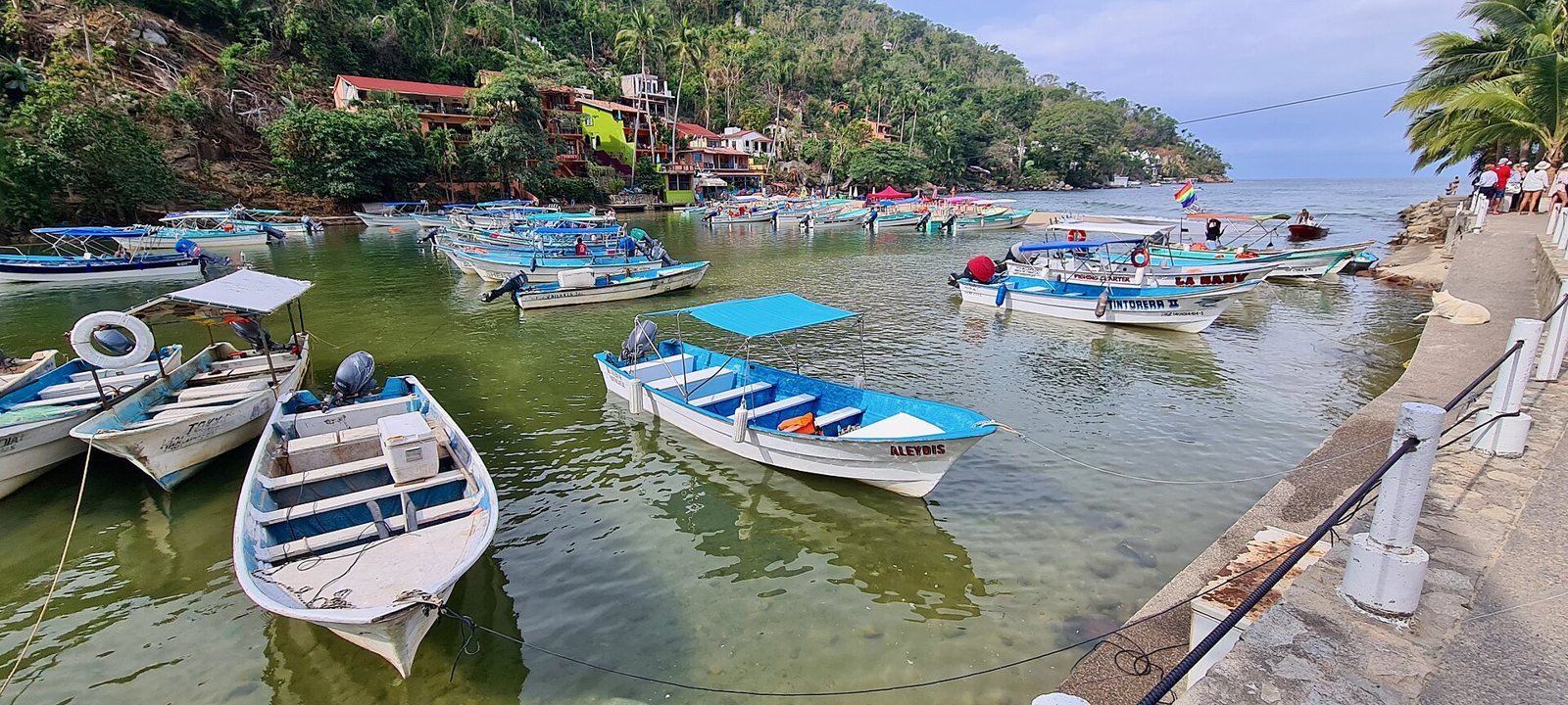 Fishing and tour pangas in Boca de Tomatlán.
Getting to Boca de Tomatlán: drive or take a taxi down Highway 200, or catch a local bus. Southbound buses leave from the corner of Basilio Badillo and Constitución in the Romantic Zone and pass through Mismaloya and Boca.
Colomitos: a tiny hidden cove
About a 5-minute panga ride from Boca, or roughly 40 minutes on foot at an easy pace, you'll find Colomitos, a small cove at the mouth of a branch of the Horcones River. Steep cliffs wrap around it, and it's known for emerald water and very gentle waves. It's a lovely spot to swim, snorkel and even scuba dive, and several day cruises stop here; hike in early and you'll find it quieter.
Las Animas Beach: the south shore favorite
Las Animas is one of the most popular beaches south of town. Think amber sand, clear water and gentle waves, all framed by tropical vegetation. Simple beachfront restaurants set out palapas and lounge chairs and serve fresh seafood and Mexican dishes, and you can snorkel, go parasailing or hop on a banana boat. Zip lines and family adventure activities are a short walk from the sand.
How to get to Las Animas Beach:
- By water taxi: take a panga or water taxi from Los Muertos Pier in the Romantic Zone, or from Boca de Tomatlán.
- On a day cruise: several boat tours leave daily from the Puerto Vallarta Cruise Port, and many make their first stop at the Las Animas pier.
- On foot: follow the coastal trail from Boca (more on that below).
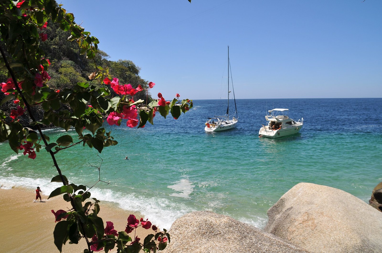 A cove along the coastal trail from Boca de Tomatlán to Las Animas.
Hiking from Boca de Tomatlán to Las Animas
One of the best ways to see the south shore is on foot. A trail leaves Boca de Tomatlán and follows the coastline up and over the hills, passing Colomitos, Las Animas and other beaches, and continuing overland all the way to Quimixto.
Puerto Vallarta's tourism board describes it as moderately strenuous: expect climbs, steps, roots and rocky stretches, rewarded with big views over the bay and quiet coves. Walking a little under 2 miles already gets you great views. The section to Las Animas is the most popular; pushing on to Quimixto makes for a long hike best left to experienced hikers in good shape. The trail gets slippery in the rainy season, so the dry months, November through May, are the most comfortable.
A classic plan is to hike out and ride a water taxi back; ask in Boca what time the last boat leaves.
Las Caletas: John Huston's hideaway
Between Boca and Quimixto, Las Caletas was John Huston's home in his final years.
In a letter written around 1980, Huston recalled that when he first came to Puerto Vallarta, nearly 30 years earlier, it was a fishing village of about 2,000 people with a single road that washed out in the rainy season. Las Caletas was half an hour south of Boca by open boat; with no roads, the sea in front and jungle behind, he called it practically "an island." He leased about 1.5 acres from the Chacala Indigenous Community for ten years, with an option for ten more, after which the land and everything built on it would return to the community.
Huston wrote of finding tracks from coatimundis, deer, wild boars, ocelots and jaguars; of flocks of parrots at dawn; and of a sea full of pelicans, a manta ray that leapt near shore and passing whales. He died on August 28, 1987, and his daughter Anjelica later said he found great happiness there. Today Las Caletas is leased by a boat tour operator, and that's how you visit.
Quimixto and its waterfall
Quimixto is a small fishing village with cobblestone lanes in the municipality of Cabo Corrientes, between Las Animas and Majahuitas, with roughly 370 residents. It's about 20 minutes by boat from Boca de Tomatlán. The beach has amber sand and green-blue water that's good for swimming, snorkeling and scuba diving, and surfers show up in fall and spring for the waves.
The big draw is the Quimixto waterfall. You can walk there through the village streets or follow a trail upstream along the La Puerta River through the jungle. Not up for the walk? You can go on horseback; the ride is just over a mile from the beach. At the base of the falls you can cool off and grab a bite.
Horses have deep roots here: before the highway, they were one of the ways people got around this coast. And Cabo Corrientes is known for rural crafts such as leatherwork, huaraches (woven sandals), rope and fiber goods, and pottery.
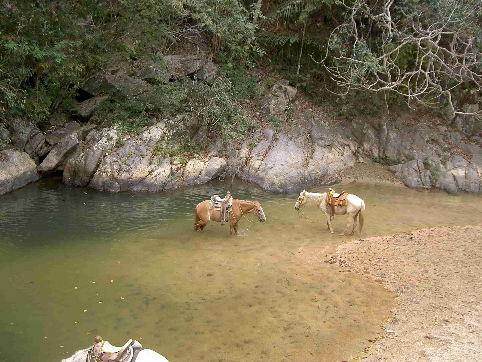 Saddled horses resting in a river pool in Quimixto.
Farther south: Majahuitas and Yelapa
Less than 2 miles by boat west of Quimixto is Majahuitas, a small cove with clear water and a rocky bottom that you can only reach by sea. Underwater it has small canyons and caves full of colorful fish, great for snorkeling, diving and kayaking.
At the end of the line is Yelapa, a beach town with no road for regular vehicles, served by boats from Puerto Vallarta and Boca de Tomatlán. Its name is usually explained as "where two rivers meet the sea"; read all about it in our Yelapa guide.
South shore nature: jungle, rivers and whales
Here the Sierra Madre Occidental drops straight into the sea: that's why the beaches are small and tucked between cliffs, and why coves like Boca, Colomitos and Quimixto each have a river running down from the mountains.
Climate. Tropical, with dry winters and rainy summers. Heavy rain falls from June through October, and the eastern Pacific hurricane season officially runs from May 15 to November 30. Cabo Corrientes averages about 24.6 °C (76 °F).
Plants. The mountains are home to cedar, walnut, oak and capomo (breadnut) trees, and local orchards grow mango, avocado, orange and guava. When the rains begin, orchids and bromeliads bloom.
Birds. Around Boca de Tomatlán you can spot parrots, egrets, herons, pelicans, hummingbirds, gulls and frigatebirds.
Whales and turtles. Humpback whales come to the bay to mate and give birth; the official 2025-2026 season ran from December 8 to March 23. Learn more in our guide to whale watching in Puerto Vallarta. From August through December, sea turtles nest around Banderas Bay.
Suggested south shore itineraries
Half day: head to Boca de Tomatlán early, hike to Colomitos, swim before the tour boats arrive, then return to Boca for a seafood lunch by the water.
Full day: hike from Boca to Las Animas by way of Colomitos, have lunch at Las Animas, then hop a panga to Quimixto and walk or ride to the waterfall. Catch a boat back before the last departure.
No hiking: take a water taxi from Los Muertos Pier or Boca, stop at Las Animas and Quimixto, and save Yelapa for another day.
Does Riviera Tours & Transfers offer a south shore tour?
No. We don't currently run a tour to Boca de Tomatlán, Las Animas or Quimixto. They're best explored on your own, by water taxi or on a boat cruise. For more ideas, see our guide to things to do in Puerto Vallarta.
If you'd also like to see downtown Puerto Vallarta with a guide, our Vallarta City Tour runs every day, lasts about 7 hours and is offered in English and Spanish. It includes:
- A guided walk through downtown Puerto Vallarta
- A visit to a traditional jewelry shop
- Free time for shopping
- A tequila stop
- A visit to a regional cuisine restaurant (meal not included)
Prefer lunch included? The Vallarta Plus City Tour adds a distillery tour, a tequila tasting and a meal at a regional cuisine restaurant.
Check dates and book the Vallarta City Tour →
Tips for visiting the south shore beaches
- Start early. The sea is usually calmer in the morning.
- Bring cash in small bills for boat fares, lounge chairs, food and horses.
- Wear real shoes on the trail. Sneakers or hiking sandals, not flip-flops. Pack water, reef-friendly sunscreen, bug spray and a dry bag for your phone.
- Budget: the local bus is the cheapest way to Boca, a shared water taxi usually costs less than a private boat, and all-inclusive cruises are the priciest. Agree on the fare before you board.
- Lock in your ride back. Ask about the last boat before you leave Boca or Los Muertos Pier.
- Wear a life jacket on the panga. Ask for one if it isn't offered.
- Respect the beach flags and lifeguard or civil protection instructions. Sea conditions and rules can change, so check current rules before you go.
- Respect local communities. These are working villages: ask before photographing people, pack out your trash and don't touch the reef.
- Timing: June through October is the rainy season, and the trail can get slippery. December through March is also whale season in the bay.
FAQ
How do I get to Las Animas Beach from Puerto Vallarta? Take a water taxi from Los Muertos Pier or Boca de Tomatlán, join a day cruise from the Cruise Port, or hike the coastal trail from Boca.
Can you hike from Boca de Tomatlán to Las Animas? Yes. A moderately strenuous coastal trail passes Colomitos along the way. Colomitos alone is about 40 minutes at an easy pace, and Las Animas is farther on. Bring water, wear good shoes and start early.
How do you get to the Quimixto waterfall? First take a boat to Quimixto (about 20 minutes from Boca). From the village, walk through town or along the river trail, or go on horseback.
When is the best time to visit Puerto Vallarta's south shore beaches? The dry season, November through May, is the most comfortable for hiking and boating. For whales, go between December and March.
Do you have to pay to use the beaches? Under Mexican law, public access to beaches can't be restricted except in cases set by regulation. You pay for transportation and, if you use them, lounge chairs, food or horses.
Which south shore beach is best for kids? Las Animas: gentle waves, shade and food, and you get there by boat without hiking.
Where did John Huston live near Puerto Vallarta? In his final years he retreated to Las Caletas, a cove south of Boca de Tomatlán that's only reachable by sea.
Photos: Bernard DUPONT / CC BY-SA 2.0 via Wikimedia Commons · Bernard DUPONT / CC BY-SA 2.0 via Wikimedia Commons · Andy Blackledge / CC BY 2.0 via Wikimedia Commons · Steve Hedin / CC BY-SA 3.0 via Wikimedia Commons